Lampertheim night lights from space
Night Light of Lampertheim (Hesse) from space (Germany) Src. Average luminocity for 10x10km area is 23.9384% and for 50x50km: 21.0246%.
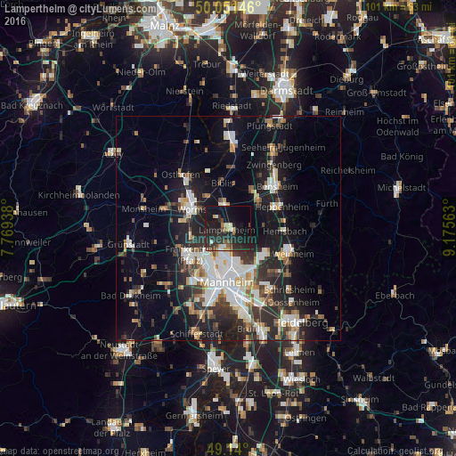
Analysis of Lampertheim night lights 2016
Square area 10x10 km:
 1.96%
1.96%90-99
1.96%80-89
2.52%70-79
1.96%60-69
1.82%50-59
2.1%40-49
3.08%30-39
5.74%20-29
20.31%10-19
34.45%0-9
24.09%Square area 50x50 km:
3.91%90-99
4.56%80-89
1.77%70-79
1.71%60-69
2.09%50-59
2.27%40-49
2.39%30-39
3.1%20-29
6.99%10-19
14.82%0-9
56.41%Clear (daylight) street map image can be seen on geolist.org.
Map coordinates:
50° 3' 5.3" North, 7° 46' 9.8" East
49° 35' 52.3" North, 8° 28' 21" East
49° 8' 24" North, 9° 10' 32.3" East
Some cities around Lampertheim sort by population:
• Worms
9 km =5.6 mi,  295°
295°
• Frankenthal
11.1 km =6.9 mi,  230°
230°
• Viernheim
10 km =6.2 mi,  130°
130°
• Bürstadt
5.1 km =3.2 mi,  349°
349°
• Lorsch
8.9 km =5.5 mi,  49°
49°
• Bobenheim-Roxheim
8.3 km =5.2 mi,  262°
262°
• Biblis
10.5 km =6.5 mi, 354°
• Einhausen
10.3 km =6.4 mi,  31°
31°
2881695 (p: 31,635)
Sources (retrieved 2019-11-25):
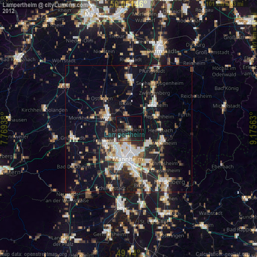
» Earth at Night: Flat Maps 2012, 2016