Oebisfelde night lights from space
Night Light of Oebisfelde (Saxony-Anhalt) from space (Germany) Src. Average luminocity for 10x10km area is 0.7702% and for 50x50km: 2.8632%.
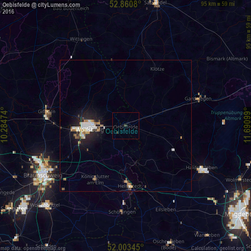
Analysis of Oebisfelde night lights 2016
Square area 10x10 km:
 0%
0%90-99
0%80-89
0%70-79
0%60-69
0%50-59
0%40-49
0.51%30-39
1.01%20-29
0%10-19
0.51%0-9
97.98%Square area 50x50 km:
0.53%90-99
0.52%80-89
0.2%70-79
0.33%60-69
0.38%50-59
0.35%40-49
0.23%30-39
0.22%20-29
0.85%10-19
2.28%0-9
94.1%Clear (daylight) street map image can be seen on geolist.org.
Map coordinates:
52° 51' 38.9" North, 10° 17' 5.1" East
52° 26' 3.2" North, 10° 59' 16.3" East
52° 0' 12.4" North, 11° 41' 27.6" East
Some cities around Oebisfelde sort by population:
• Wolfsburg
14 km =8.7 mi,  265°
265°
• Helmstedt
23 km =14.3 mi,  176°
176°
• Königslutter am Elm
23.4 km =14.5 mi,  209°
209°
• Lehre
24.5 km =15.2 mi,  242°
242°
• Sassenburg
25.7 km =16 mi,  290°
290°
• Westhagen
17.2 km =10.7 mi,  258°
258°
• Detmerode
17.2 km =10.7 mi,  253°
253°
• Klötze
24.6 km =15.3 mi,  29°
29°
2857985 (p: 7,341)
Sources (retrieved 2019-11-25):
» Earth at Night: Flat Maps 2012, 2016