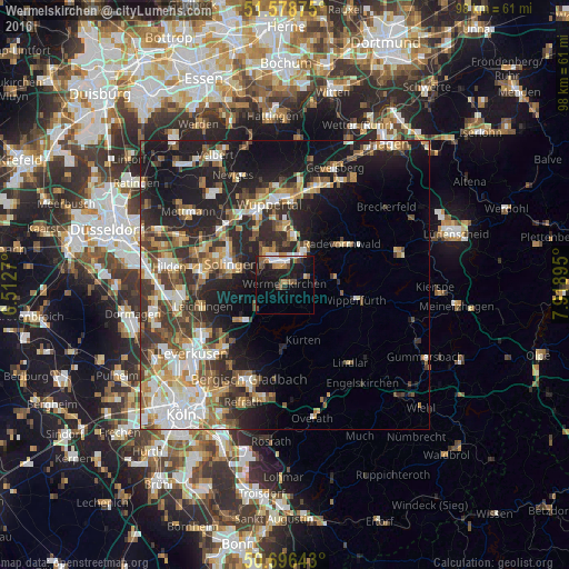
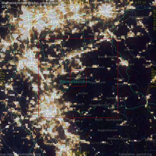
Wermelskirchen night lights from space
Night Light of Wermelskirchen (North Rhine-Westphalia) from space (Germany) Src. Average luminocity for 10x10km area is 20.0521% and for 50x50km: 26.2334%.
Analysis of Wermelskirchen night lights 2016
Square area 10x10 km:
 3.34%
3.34%90-99
2.27%80-89
0.67%70-79
2.41%60-69
2.94%50-59
3.88%40-49
2.27%30-39
1.34%20-29
5.48%10-19
23.93%0-9
51.47%Square area 50x50 km:
4.11%90-99
4.76%80-89
2.39%70-79
3.5%60-69
3.71%50-59
3.91%40-49
4.09%30-39
5.09%20-29
7.91%10-19
14.95%0-9
45.56%Clear (daylight) street map image can be seen on geolist.org.
Map coordinates:
51° 34' 43.5" North, 6° 30' 45.7" East
51° 8' 22.9" North, 7° 12' 57" East
50° 41' 47.1" North, 7° 55' 8.2" East
Some cities around Wermelskirchen sort by population:
• Solingen
9.9 km =6.2 mi,  292°
292°
• Remscheid
4.7 km =2.9 mi,  339°
339°
• Radevormwald
12.2 km =7.6 mi,  55°
55°
• Wipperfürth
13 km =8.1 mi,  101°
101°
• Kürten
10.6 km =6.6 mi,  160°
160°
• Burscheid
9.4 km =5.8 mi,  229°
229°
• Hückeswagen
9.1 km =5.7 mi,  82°
82°
• Odenthal
13.7 km =8.5 mi,  210°
210°
2810855 (p: 36,816)
Sources (retrieved 2019-11-25):
» Earth at Night: Flat Maps 2012, 2016