Braunfels night lights from space
Night Light of Braunfels (Hesse) from space (Germany) Src. Average luminocity for 10x10km area is 0.5546% and for 50x50km: 4.7032%.
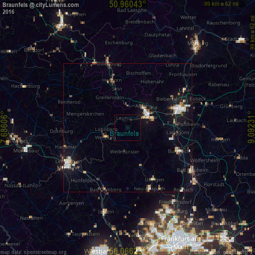
Analysis of Braunfels night lights 2016
Square area 10x10 km:
 0%
0%90-99
0%80-89
0%70-79
0%60-69
0%50-59
0%40-49
0%30-39
0%20-29
0.56%10-19
0.14%0-9
99.3%Square area 50x50 km:
0.66%90-99
0.76%80-89
0.43%70-79
0.48%60-69
0.56%50-59
0.5%40-49
0.65%30-39
0.59%20-29
0.54%10-19
3.73%0-9
91.1%Clear (daylight) street map image can be seen on geolist.org.
Map coordinates:
50° 57' 37.5" North, 7° 41' 9.8" East
50° 30' 55.6" North, 8° 23' 21" East
50° 3' 58.4" North, 9° 5' 32.3" East
Some cities around Braunfels sort by population:
• Wetzlar
9.6 km =6 mi,  58°
58°
• Weilburg
9.6 km =6 mi,  248°
248°
• Solms
2.6 km =1.6 mi,  28°
28°
• Ehringshausen
9.4 km =5.8 mi,  357°
357°
• Weilmünster
9.4 km =5.8 mi,  185°
185°
• Selters
7 km =4.3 mi,  271°
271°
• Schöffengrund
6.3 km =3.9 mi,  112°
112°
• Leun
4.5 km =2.8 mi,  331°
331°
2945073 (p: 11,510)
Sources (retrieved 2019-11-25):
» Earth at Night: Flat Maps 2012, 2016