Osterhofen night lights from space
Night Light of Osterhofen (Bavaria) from space (Germany) Src. Average luminocity for 10x10km area is 2.564% and for 50x50km: 1.7478%.
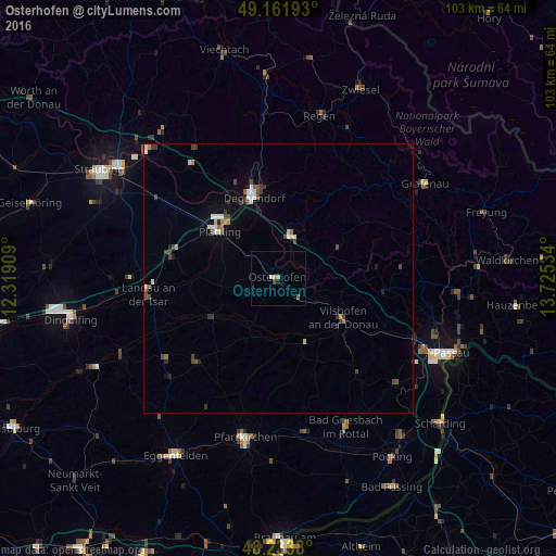
Analysis of Osterhofen night lights 2016
Square area 10x10 km:
 0.3%
0.3%90-99
0.3%80-89
0%70-79
1.19%60-69
0%50-59
0.6%40-49
0%30-39
0.6%20-29
0%10-19
0.6%0-9
96.43%Square area 50x50 km:
0.2%90-99
0.26%80-89
0.17%70-79
0.12%60-69
0.18%50-59
0.2%40-49
0.4%30-39
0.45%20-29
0.36%10-19
0.25%0-9
97.42%Clear (daylight) street map image can be seen on geolist.org.
Map coordinates:
49° 9' 42.9" North, 12° 19' 8.7" East
48° 42' 0" North, 13° 1' 20" East
48° 14' 1.7" North, 13° 43' 31.2" East
Some cities around Osterhofen sort by population:
• Deggendorf
16.3 km =10.1 mi,  343°
343°
• Vilshofen
14.9 km =9.3 mi,  123°
123°
• Plattling
13.9 km =8.6 mi,  309°
309°
• Hengersberg
8.4 km =5.2 mi,  16°
16°
• Wallersdorf
20.6 km =12.8 mi,  281°
281°
• Eichendorf
14.3 km =8.9 mi,  238°
238°
• Arnstorf
21.8 km =13.5 mi,  223°
223°
• Schöllnach
12.9 km =8 mi,  62°
62°
2856530 (p: 11,870)
Sources (retrieved 2019-11-25):
» Earth at Night: Flat Maps 2012, 2016