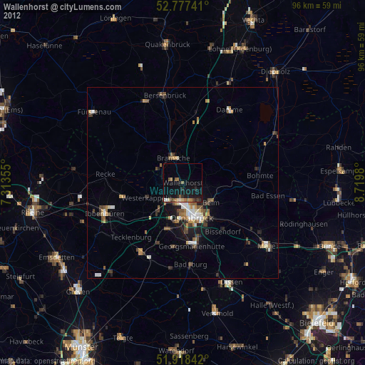
Wallenhorst night lights from space
Night Light of Wallenhorst (Lower Saxony) from space (Germany) Src. Average luminocity for 10x10km area is 10.428% and for 50x50km: 3.9355%.
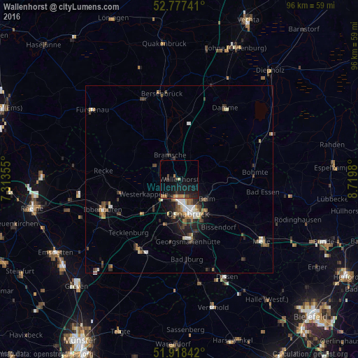
Analysis of Wallenhorst night lights 2016
Square area 10x10 km:
 0%
0%90-99
0.25%80-89
1.01%70-79
1.52%60-69
2.27%50-59
0%40-49
1.89%30-39
2.53%20-29
3.41%10-19
18.43%0-9
68.69%Square area 50x50 km:
0.42%90-99
0.57%80-89
0.34%70-79
0.39%60-69
0.61%50-59
0.58%40-49
0.66%30-39
0.86%20-29
0.96%10-19
2.51%0-9
92.1%Clear (daylight) street map image can be seen on geolist.org.
Map coordinates:
52° 46' 38.7" North, 7° 18' 48.8" East
52° 21' 0" North, 8° 1' 0" East
51° 55' 6.3" North, 8° 43' 11.3" East
Some cities around Wallenhorst sort by population:
• Osnabrück
8.9 km =5.5 mi,  165°
165°
• Bramsche
7.2 km =4.5 mi,  335°
335°
• Belm
9.7 km =6 mi,  125°
125°
• Lotte
10.1 km =6.3 mi,  222°
222°
• Mettingen
16.3 km =10.1 mi,  256°
256°
• Westerkappeln
9.8 km =6.1 mi,  247°
247°
• Hasbergen
13.1 km =8.1 mi,  196°
196°
• Ostercappeln
14.7 km =9.1 mi,  90°
90°
2814632 (p: 24,201)
Sources (retrieved 2019-11-25):
» Earth at Night: Flat Maps 2012, 2016