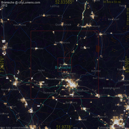
Bramsche night lights from space
Night Light of Bramsche (Lower Saxony) from space (Germany) Src. Average luminocity for 10x10km area is 1.3977% and for 50x50km: 3.6084%.
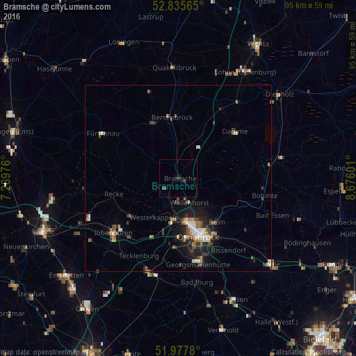
Analysis of Bramsche night lights 2016
Square area 10x10 km:
 0%
0%90-99
0%80-89
0%70-79
0%60-69
0%50-59
0%40-49
1.01%30-39
0.51%20-29
0.88%10-19
0.76%0-9
96.84%Square area 50x50 km:
0.38%90-99
0.54%80-89
0.31%70-79
0.42%60-69
0.51%50-59
0.54%40-49
0.54%30-39
0.8%20-29
0.88%10-19
2.45%0-9
92.63%Clear (daylight) street map image can be seen on geolist.org.
Map coordinates:
52° 50' 8.3" North, 7° 16' 11.1" East
52° 24' 31.7" North, 7° 58' 22.4" East
51° 58' 40.1" North, 8° 40' 33.6" East
Some cities around Bramsche sort by population:
• Osnabrück
16 km =9.9 mi,  160°
160°
• Wallenhorst
7.2 km =4.5 mi, 155°
• Belm
16.3 km =10.1 mi,  137°
137°
• Lotte
14.5 km =9 mi,  195°
195°
• Mettingen
16.5 km =10.3 mi,  231°
231°
• Westerkappeln
11.9 km =7.4 mi,  210°
210°
• Bersenbrück
16 km =9.9 mi,  354°
354°
• Ankum
16.8 km =10.4 mi,  338°
338°
2945474 (p: 31,394)
Sources (retrieved 2019-11-25):
» Earth at Night: Flat Maps 2012, 2016