Waldmünchen night lights from space
Night Light of Waldmünchen (Bavaria) from space (Germany) Src. Average luminocity for 10x10km area is 0.0856% and for 50x50km: 0.9258%.
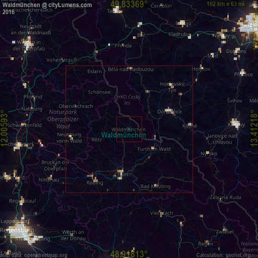
Analysis of Waldmünchen night lights 2016
Square area 10x10 km:
 0%
0%90-99
0%80-89
0%70-79
0%60-69
0%50-59
0%40-49
0%30-39
0%20-29
0%10-19
0.53%0-9
99.47%Square area 50x50 km:
0.06%90-99
0.12%80-89
0.03%70-79
0.17%60-69
0.17%50-59
0.27%40-49
0.09%30-39
0.25%20-29
0.22%10-19
0.15%0-9
98.46%Clear (daylight) street map image can be seen on geolist.org.
Map coordinates:
49° 50' 1.3" North, 12° 0' 21.3" East
49° 22' 40.9" North, 12° 42' 32.6" East
48° 55' 5.3" North, 13° 24' 43.8" East
Some cities around Waldmünchen sort by population:
• Cham
17.4 km =10.8 mi,  193°
193°
• Roding
24.6 km =15.3 mi,  213°
213°
• Domažlice, CZ
17.4 km =10.8 mi,  66°
66°
• Furth im Wald
12.3 km =7.6 mi,  128°
128°
• Neunburg vorm Wald
23.6 km =14.7 mi,  261°
261°
• Kötzting
24.8 km =15.4 mi,  154°
154°
• Nýrsko, CZ
32.8 km =20.4 mi,  106°
106°
• Oberviechtach
22.9 km =14.2 mi,  292°
292°
2814846 (p: 7,392)
Sources (retrieved 2019-11-25):
» Earth at Night: Flat Maps 2012, 2016