Roding night lights from space
Night Light of Roding (Bavaria) from space (Germany) Src. Average luminocity for 10x10km area is 3.3683% and for 50x50km: 1.2699%.
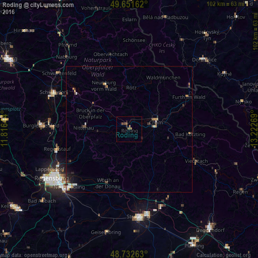
Analysis of Roding night lights 2016
Square area 10x10 km:
 0%
0%90-99
0%80-89
0%70-79
0%60-69
1.68%50-59
1.96%40-49
0.42%30-39
1.12%20-29
0.7%10-19
0%0-9
94.12%Square area 50x50 km:
0.13%90-99
0.19%80-89
0.08%70-79
0.22%60-69
0.14%50-59
0.15%40-49
0.22%30-39
0.28%20-29
0.38%10-19
0.75%0-9
97.47%Clear (daylight) street map image can be seen on geolist.org.
Map coordinates:
49° 39' 5.8" North, 11° 48' 59.2" East
49° 11' 39.3" North, 12° 31' 10.4" East
48° 43' 57.5" North, 13° 13' 21.7" East
Some cities around Roding sort by population:
• Cham
10.4 km =6.5 mi,  70°
70°
• Furth im Wald
26.7 km =16.6 mi,  61°
61°
• Nittenau
18.3 km =11.4 mi,  269°
269°
• Neunburg vorm Wald
19.6 km =12.2 mi,  330°
330°
• Wenzenbach
26.8 km =16.7 mi,  240°
240°
• Kötzting
24.5 km =15.2 mi,  94°
94°
• Waldmünchen
24.6 km =15.3 mi,  33°
33°
• Bernhardswald
22.9 km =14.2 mi, 239°
2845924 (p: 11,406)
Sources (retrieved 2019-11-25):
» Earth at Night: Flat Maps 2012, 2016