Waghäusel night lights from space
Night Light of Waghäusel (Baden-Württemberg) from space (Germany) Src. Average luminocity for 10x10km area is 28.1604% and for 50x50km: 21.4589%.
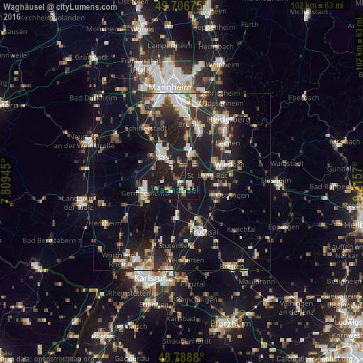
Analysis of Waghäusel night lights 2016
Square area 10x10 km:
 2.94%
2.94%90-99
4.28%80-89
2.67%70-79
2.54%60-69
3.34%50-59
2.67%40-49
4.14%30-39
1.47%20-29
7.35%10-19
58.16%0-9
10.43%Square area 50x50 km:
2.96%90-99
3.55%80-89
2.08%70-79
1.91%60-69
2.52%50-59
2.52%40-49
2.78%30-39
3.13%20-29
7.92%10-19
21.5%0-9
49.14%Clear (daylight) street map image can be seen on geolist.org.
Map coordinates:
49° 42' 24.3" North, 7° 48' 34" East
49° 14' 59.7" North, 8° 30' 45.3" East
48° 47' 19.7" North, 9° 12' 56.5" East
Some cities around Waghäusel sort by population:
• Hockenheim
8.6 km =5.3 mi,  19°
19°
• Philippsburg
4.3 km =2.7 mi,  241°
241°
• Sankt Leon-Rot
7.9 km =4.9 mi,  76°
76°
• Oberhausen-Rheinhausen
4 km =2.5 mi,  311°
311°
• Reilingen
6.6 km =4.1 mi,  34°
34°
• Neulußheim
5.4 km =3.4 mi,  4°
4°
• Hambrücken
7 km =4.3 mi,  163°
163°
• Altlußheim
5.8 km =3.6 mi,  350°
350°
2815487 (p: 20,178)
Sources (retrieved 2019-11-25):
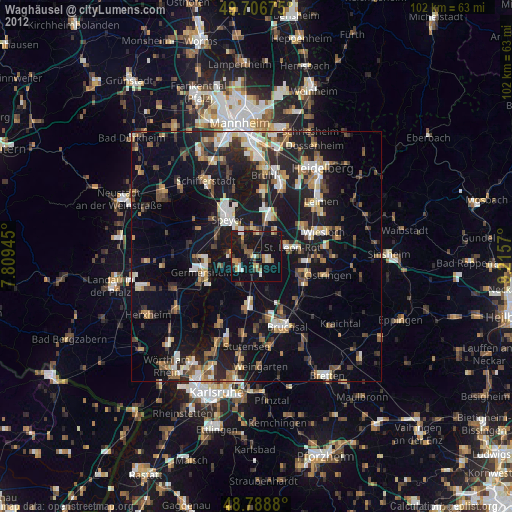
» Earth at Night: Flat Maps 2012, 2016