Vetschau night lights from space
Night Light of Vetschau (Brandenburg) from space (Germany) Src. Average luminocity for 10x10km area is 1.4832% and for 50x50km: 2.5766%.
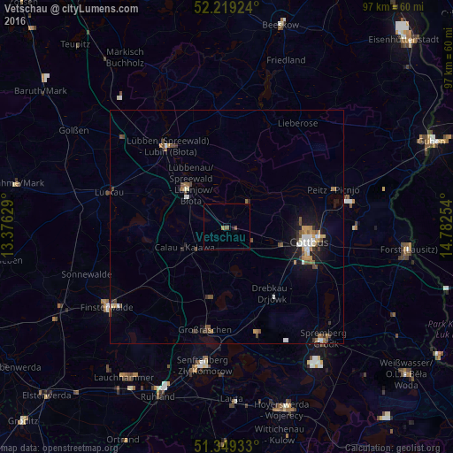
Analysis of Vetschau night lights 2016
Square area 10x10 km:
 0%
0%90-99
0%80-89
0%70-79
0%60-69
0.56%50-59
1.68%40-49
0%30-39
0%20-29
0%10-19
0.56%0-9
97.2%Square area 50x50 km:
0.3%90-99
0.38%80-89
0.13%70-79
0.35%60-69
0.38%50-59
0.49%40-49
0.52%30-39
0.36%20-29
0.25%10-19
1.73%0-9
95.11%Clear (daylight) street map image can be seen on geolist.org.
Map coordinates:
52° 13' 9.3" North, 13° 22' 34.6" East
51° 47' 11" North, 14° 4' 45.9" East
51° 20' 57.6" North, 14° 46' 57.1" East
Some cities around Vetschau sort by population:
• Cottbus
17.5 km =10.9 mi,  100°
100°
• Lübbenau
12.2 km =7.6 mi,  313°
313°
• Lübben
21.4 km =13.3 mi,  322°
322°
• Großräschen
22.6 km =14 mi,  192°
192°
• Kolkwitz
12.4 km =7.7 mi,  109°
109°
• Calau
9.9 km =6.2 mi,  241°
241°
• Drebkau
17.7 km =11 mi,  146°
146°
• Peitz
24.2 km =15 mi,  70°
70°
2817517 (p: 9,857)
Sources (retrieved 2019-11-25):
» Earth at Night: Flat Maps 2012, 2016