Kolkwitz night lights from space
Night Light of Kolkwitz (Brandenburg) from space (Germany) Src. Average luminocity for 10x10km area is 11.3389% and for 50x50km: 2.9814%.
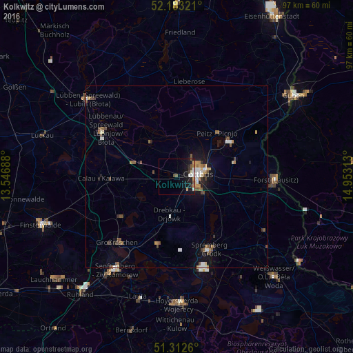
Analysis of Kolkwitz night lights 2016
Square area 10x10 km:
 1.4%
1.4%90-99
2.24%80-89
0.28%70-79
1.68%60-69
1.12%50-59
1.54%40-49
1.68%30-39
1.54%20-29
1.68%10-19
14.71%0-9
72.13%Square area 50x50 km:
0.39%90-99
0.44%80-89
0.19%70-79
0.34%60-69
0.43%50-59
0.56%40-49
0.48%30-39
0.4%20-29
0.24%10-19
2.12%0-9
94.41%Clear (daylight) street map image can be seen on geolist.org.
Map coordinates:
52° 10' 59.6" North, 13° 32' 48.8" East
51° 45' 0" North, 14° 15' 0" East
51° 18' 45.4" North, 14° 57' 11.3" East
Some cities around Kolkwitz sort by population:
• Cottbus
5.5 km =3.4 mi,  81°
81°
• Forst
26.9 km =16.7 mi,  93°
93°
• Lübbenau
24 km =14.9 mi,  301°
301°
• Großräschen
24.5 km =15.2 mi,  222°
222°
• Vetschau
12.4 km =7.7 mi,  289°
289°
• Calau
20.4 km =12.7 mi,  268°
268°
• Drebkau
10.8 km =6.7 mi,  189°
189°
• Peitz
16.4 km =10.2 mi,  42°
42°
2886382 (p: 10,225)
Sources (retrieved 2019-11-25):
» Earth at Night: Flat Maps 2012, 2016