Uffenheim night lights from space
Night Light of Uffenheim (Bavaria) from space (Germany) Src. Average luminocity for 10x10km area is 4.5266% and for 50x50km: 1.8949%.
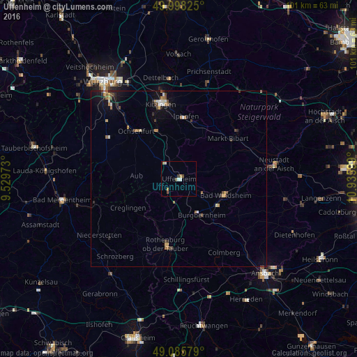
Analysis of Uffenheim night lights 2016
Square area 10x10 km:
 0.56%
0.56%90-99
1.12%80-89
0%70-79
1.12%60-69
0.56%50-59
0.14%40-49
1.54%30-39
0.56%20-29
0%10-19
0%0-9
94.4%Square area 50x50 km:
0.17%90-99
0.25%80-89
0.12%70-79
0.3%60-69
0.33%50-59
0.24%40-49
0.35%30-39
0.22%20-29
0.26%10-19
1.21%0-9
96.54%Clear (daylight) street map image can be seen on geolist.org.
Map coordinates:
49° 59' 53.7" North, 9° 31' 47" East
49° 32' 38.9" North, 10° 13' 58.3" East
49° 5' 8.8" North, 10° 56' 9.6" East
Some cities around Uffenheim sort by population:
• Kitzingen
22.5 km =14 mi,  344°
344°
• Neustadt an der Aisch
27.6 km =17.1 mi,  81°
81°
• Bad Windsheim
14 km =8.7 mi,  109°
109°
• Ochsenfurt
18.2 km =11.3 mi,  317°
317°
• Rothenburg ob der Tauber
18.7 km =11.6 mi,  190°
190°
• Weikersheim
25.1 km =15.6 mi,  253°
253°
• Schrozberg
28.7 km =17.8 mi,  219°
219°
• Niederstetten
27.7 km =17.2 mi,  234°
234°
2820423 (p: 6,542)
Sources (retrieved 2019-11-25):
» Earth at Night: Flat Maps 2012, 2016