Traunstein night lights from space
Night Light of Traunstein (Bavaria) from space (Germany) Src. Average luminocity for 10x10km area is 6.0909% and for 50x50km: 2.1215%.
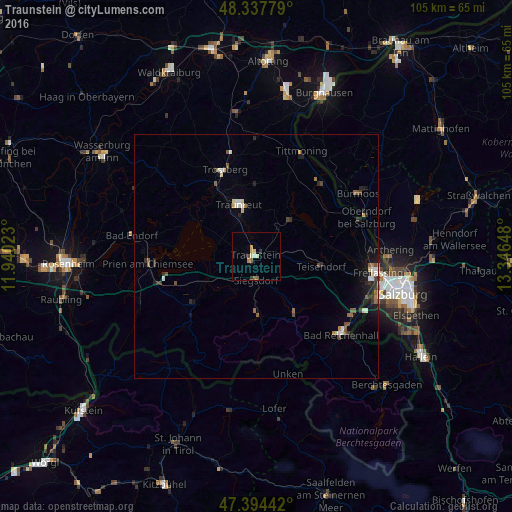
Analysis of Traunstein night lights 2016
Square area 10x10 km:
 0.43%
0.43%90-99
0.14%80-89
1.99%70-79
0.85%60-69
0.71%50-59
1.14%40-49
0.99%30-39
0.71%20-29
0.43%10-19
0.71%0-9
91.9%Square area 50x50 km:
0.23%90-99
0.26%80-89
0.27%70-79
0.14%60-69
0.23%50-59
0.41%40-49
0.31%30-39
0.33%20-29
0.51%10-19
1.13%0-9
96.18%Clear (daylight) street map image can be seen on geolist.org.
Map coordinates:
48° 20' 16" North, 11° 56' 24.8" East
47° 52' 5.7" North, 12° 38' 36.1" East
47° 23' 39.9" North, 13° 20' 47.3" East
Some cities around Traunstein sort by population:
• Trostberg an der Alz
18.9 km =11.7 mi,  340°
340°
• Prien am Chiemsee
22.2 km =13.8 mi,  266°
266°
• Teisendorf
13.3 km =8.3 mi,  99°
99°
• Siegsdorf
5.1 km =3.2 mi,  180°
180°
• Bernau am Chiemsee
20.9 km =13 mi,  252°
252°
• Ruhpolding
11.3 km =7 mi, 177°
• Grassau
17.2 km =10.7 mi,  235°
235°
• Waging am See
10 km =6.2 mi,  42°
42°
2821515 (p: 18,422)
Sources (retrieved 2019-11-25):
» Earth at Night: Flat Maps 2012, 2016