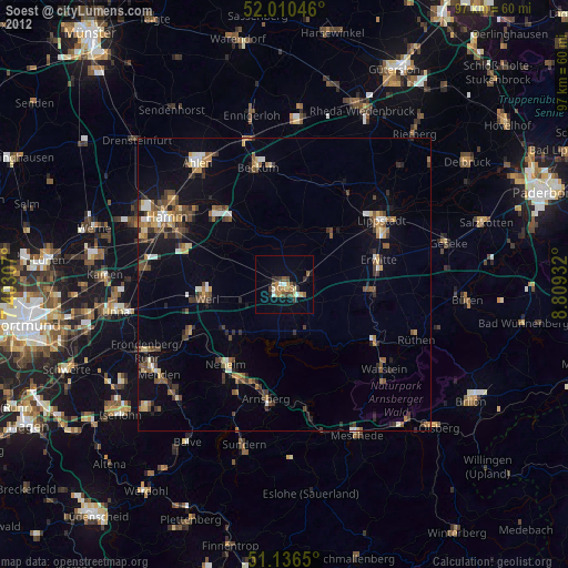
Soest night lights from space
Night Light of Soest (North Rhine-Westphalia) from space (Germany) Src. Average luminocity for 10x10km area is 16.139% and for 50x50km: 7.2145%.
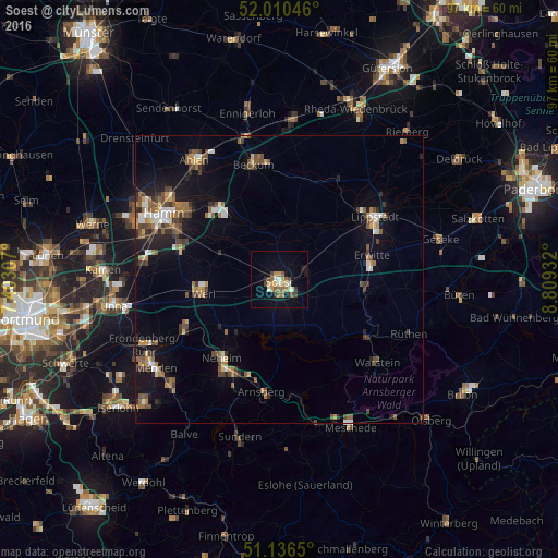
Analysis of Soest night lights 2016
Square area 10x10 km:
 0.94%
0.94%90-99
2.14%80-89
2.27%70-79
2.67%60-69
2.94%50-59
2.41%40-49
2.27%30-39
2.27%20-29
1.07%10-19
9.36%0-9
71.66%Square area 50x50 km:
0.65%90-99
0.83%80-89
0.54%70-79
0.72%60-69
1.3%50-59
1.38%40-49
1.47%30-39
1.27%20-29
1.15%10-19
4.46%0-9
86.23%Clear (daylight) street map image can be seen on geolist.org.
Map coordinates:
52° 0' 37.7" North, 7° 24' 11.1" East
51° 34' 32.1" North, 8° 6' 22.3" East
51° 8' 11.4" North, 8° 48' 33.6" East
Some cities around Soest sort by population:
• Lippstadt
19.8 km =12.3 mi,  56°
56°
• Werl
13.5 km =8.4 mi,  260°
260°
• Erwitte
16.6 km =10.3 mi,  75°
75°
• Welver
10.7 km =6.6 mi,  295°
295°
• Wickede
18.8 km =11.7 mi,  242°
242°
• Bad Sassendorf
4.3 km =2.7 mi, 78°
• Möhnesee
8.6 km =5.3 mi,  167°
167°
• Anröchte
15.7 km =9.8 mi,  93°
93°
2831708 (p: 48,037)
Sources (retrieved 2019-11-25):
» Earth at Night: Flat Maps 2012, 2016