Lippstadt night lights from space
Night Light of Lippstadt (North Rhine-Westphalia) from space (Germany) Src. Average luminocity for 10x10km area is 14.2941% and for 50x50km: 4.2708%.
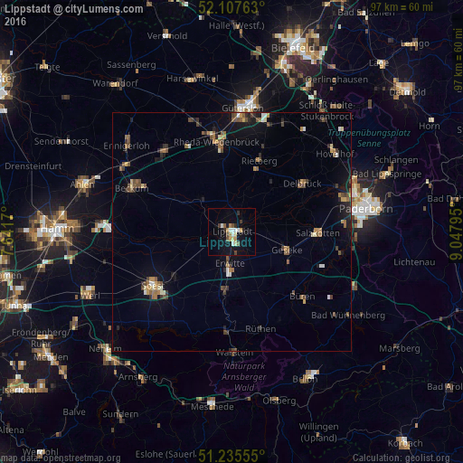
Analysis of Lippstadt night lights 2016
Square area 10x10 km:
 2.52%
2.52%90-99
1.4%80-89
1.68%70-79
1.54%60-69
1.96%50-59
1.4%40-49
1.82%30-39
1.26%20-29
2.1%10-19
8.68%0-9
75.63%Square area 50x50 km:
0.26%90-99
0.34%80-89
0.39%70-79
0.5%60-69
0.64%50-59
0.83%40-49
0.98%30-39
0.61%20-29
0.77%10-19
2.46%0-9
92.22%Clear (daylight) street map image can be seen on geolist.org.
Map coordinates:
52° 6' 27.5" North, 7° 38' 30.1" East
51° 40' 25.3" North, 8° 20' 41.4" East
51° 14' 8" North, 9° 2' 52.6" East
Some cities around Lippstadt sort by population:
• Rietberg
16.1 km =10 mi,  20°
20°
• Salzkotten
17.7 km =11 mi,  90°
90°
• Geseke
12 km =7.5 mi,  107°
107°
• Erwitte
6.8 km =4.2 mi,  183°
183°
• Wadersloh
9.3 km =5.8 mi,  315°
315°
• Bad Sassendorf
15.9 km =9.9 mi,  230°
230°
• Anröchte
11.9 km =7.4 mi, 183°
• Langenberg
11.1 km =6.9 mi,  350°
350°
2876865 (p: 67,219)
Sources (retrieved 2019-11-25):
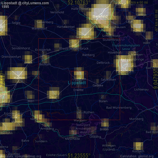
» NASA, Earths city lights 1995
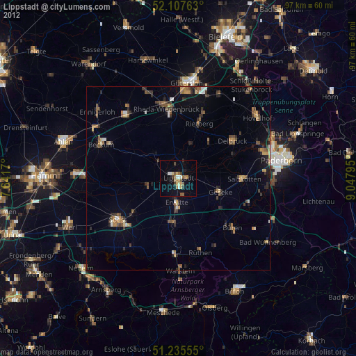
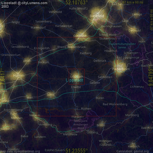
» NASA city lights 2003
» Earth at Night: Flat Maps 2012, 2016