Schwalmtal night lights from space
Night Light of Schwalmtal (North Rhine-Westphalia) from space (Germany) Src. Average luminocity for 10x10km area is 10.479% and for 50x50km: 19.4744%.
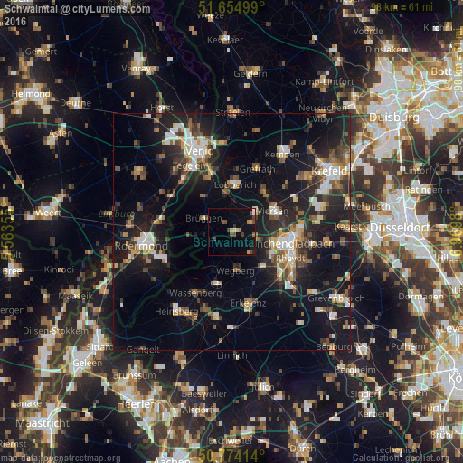
Analysis of Schwalmtal night lights 2016
Square area 10x10 km:
 0.28%
0.28%90-99
0.28%80-89
1.82%70-79
1.4%60-69
0.98%50-59
1.96%40-49
3.22%30-39
1.96%20-29
0.7%10-19
5.04%0-9
82.35%Square area 50x50 km:
2.22%90-99
3.14%80-89
1.66%70-79
1.68%60-69
2.22%50-59
3.03%40-49
3.61%30-39
2.8%20-29
6.54%10-19
17.49%0-9
55.61%Clear (daylight) street map image can be seen on geolist.org.
Map coordinates:
51° 39' 18" North, 5° 33' 48.8" East
51° 13' 0" North, 6° 16' 0" East
50° 46' 26.9" North, 6° 58' 11.3" East
Some cities around Schwalmtal sort by population:
• Mönchengladbach
12.7 km =7.9 mi,  105°
105°
• Viersen
9.8 km =6.1 mi,  64°
64°
• Nettetal
11.2 km =7 mi,  5°
5°
• Wegberg
8.4 km =5.2 mi,  171°
171°
• Wassenberg
15.1 km =9.4 mi,  211°
211°
• Brüggen
6.4 km =4 mi,  294°
294°
• Grefrath
14.3 km =8.9 mi,  21°
21°
• Niederkrüchten
3.9 km =2.4 mi,  241°
241°
2835342 (p: 19,435)
Sources (retrieved 2019-11-25):
» Earth at Night: Flat Maps 2012, 2016