Schlitz night lights from space
Night Light of Schlitz (Hesse) from space (Germany) Src. Average luminocity for 10x10km area is 0% and for 50x50km: 2.1175%.
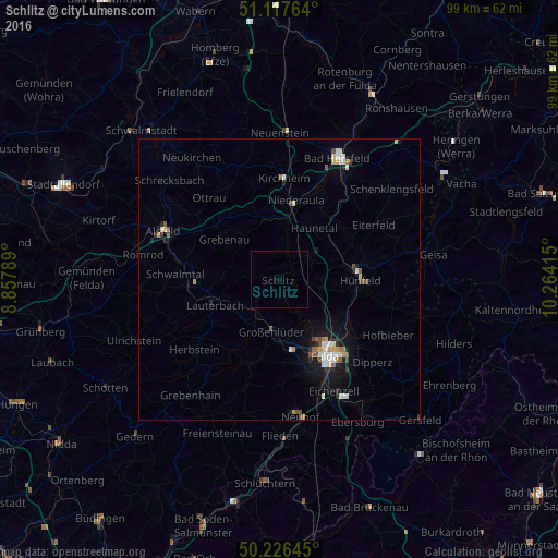
Analysis of Schlitz night lights 2016
Square area 10x10 km:
 0%
0%90-99
0%80-89
0%70-79
0%60-69
0%50-59
0%40-49
0%30-39
0%20-29
0%10-19
0%0-9
100%Square area 50x50 km:
0.33%90-99
0.38%80-89
0.21%70-79
0.19%60-69
0.23%50-59
0.28%40-49
0.34%30-39
0.08%20-29
0.35%10-19
1.52%0-9
96.1%Clear (daylight) street map image can be seen on geolist.org.
Map coordinates:
51° 7' 3.5" North, 8° 51' 28.4" East
50° 40' 27" North, 9° 33' 39.7" East
50° 13' 35.2" North, 10° 15' 50.9" East
Some cities around Schlitz sort by population:
• Fulda
15.8 km =9.8 mi,  149°
149°
• Hünfeld
14.5 km =9 mi,  87°
87°
• Künzell
18.2 km =11.3 mi,  142°
142°
• Lauterbach
12.3 km =7.6 mi,  249°
249°
• Großenlüder
9.2 km =5.7 mi,  188°
188°
• Eiterfeld
19.7 km =12.2 mi,  58°
58°
• Burghaun
11.8 km =7.3 mi,  77°
77°
• Niederaula
14.3 km =8.9 mi,  11°
11°
2838459 (p: 10,258)
Sources (retrieved 2019-11-25):
» Earth at Night: Flat Maps 2012, 2016