Liestal night lights from space
Night Light of Liestal (Basel-Landschaft) from space (Switzerland) Src. Average luminocity for 10x10km area is 25.3722% and for 50x50km: 16.9601%.
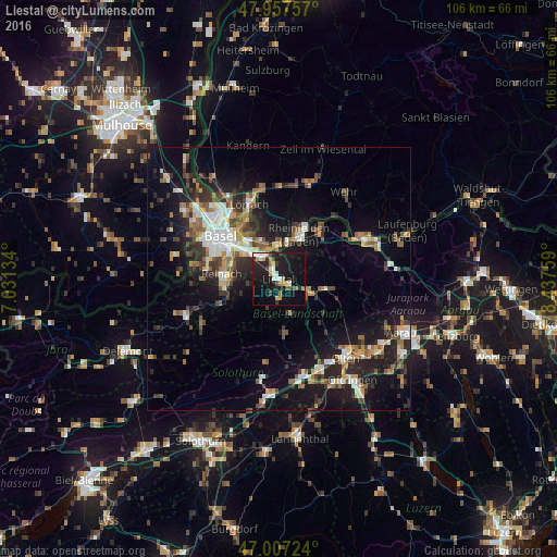
Analysis of Liestal night lights 2016
Square area 10x10 km:
 2.7%
2.7%90-99
4.4%80-89
1.42%70-79
3.84%60-69
3.55%50-59
1.14%40-49
2.98%30-39
2.84%20-29
8.52%10-19
39.06%0-9
29.55%Square area 50x50 km:
2.18%90-99
2.75%80-89
1.19%70-79
1.83%60-69
2.26%50-59
2.61%40-49
2.52%30-39
2.86%20-29
5.3%10-19
13.54%0-9
62.96%Clear (daylight) street map image can be seen on geolist.org.
Map coordinates:
47° 57' 27.3" North, 7° 1' 52.8" East
47° 29' 4.4" North, 7° 44' 4.1" East
47° 0' 26.1" North, 8° 26' 15.3" East
Some cities around Liestal sort by population:
• Muttenz
7.9 km =4.9 mi,  302°
302°
• Pratteln
5.1 km =3.2 mi,  322°
322°
• Grenzach-Wyhlen, DE
8.2 km =5.1 mi,  332°
332°
• Rheinfelden
9 km =5.6 mi,  29°
29°
• Arlesheim
8.7 km =5.4 mi,  277°
277°
• Dornach
8.9 km =5.5 mi,  267°
267°
• Frenkendorf
2.8 km =1.7 mi, 331°
• Sissach
6 km =3.7 mi,  112°
112°
2659891 (p: 12,832)
Sources (retrieved 2019-11-25):
» Earth at Night: Flat Maps 2012, 2016