Spelle night lights from space
Night Light of Spelle (Lower Saxony) from space (Germany) Src. Average luminocity for 10x10km area is 7.3472% and for 50x50km: 3.459%.
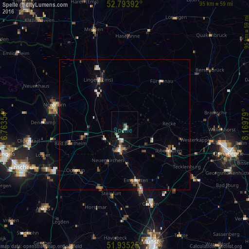
Analysis of Spelle night lights 2016
Square area 10x10 km:
 1.26%
1.26%90-99
1.26%80-89
0.51%70-79
0%60-69
0.63%50-59
1.01%40-49
1.39%30-39
0%20-29
0%10-19
8.84%0-9
85.1%Square area 50x50 km:
0.35%90-99
0.47%80-89
0.21%70-79
0.26%60-69
0.46%50-59
0.73%40-49
0.73%30-39
0.5%20-29
0.47%10-19
1.5%0-9
94.3%Clear (daylight) street map image can be seen on geolist.org.
Map coordinates:
52° 47' 38.1" North, 6° 45' 48.7" East
52° 22' 0" North, 7° 28' 0" East
51° 56' 6.9" North, 8° 10' 11.2" East
Some cities around Spelle sort by population:
• Rheine
9.2 km =5.7 mi,  191°
191°
• Hörstel
11.1 km =6.9 mi,  133°
133°
• Neuenkirchen
15 km =9.3 mi,  205°
205°
• Recke
17.3 km =10.7 mi,  89°
89°
• Schüttorf
17.3 km =10.7 mi,  253°
253°
• Emsbüren
11.9 km =7.4 mi,  288°
288°
• Salzbergen
8.7 km =5.4 mi,  244°
244°
• Freren
14.3 km =8.9 mi,  21°
21°
2830652 (p: 8,327)
Sources (retrieved 2019-11-25):
» Earth at Night: Flat Maps 2012, 2016