Regen night lights from space
Night Light of Regen (Bavaria) from space (Germany) Src. Average luminocity for 10x10km area is 0.9673% and for 50x50km: 1.4558%.
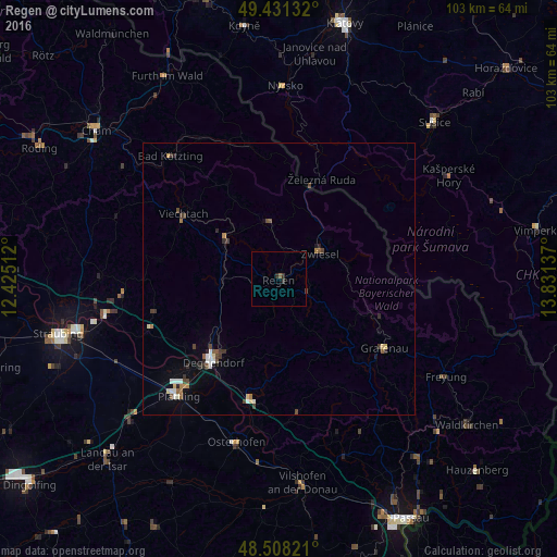
Analysis of Regen night lights 2016
Square area 10x10 km:
 0%
0%90-99
0%80-89
0%70-79
0%60-69
0%50-59
0.57%40-49
0%30-39
0.71%20-29
0.99%10-19
0%0-9
97.73%Square area 50x50 km:
0.18%90-99
0.21%80-89
0.18%70-79
0.06%60-69
0.18%50-59
0.21%40-49
0.29%30-39
0.32%20-29
0.28%10-19
0.21%0-9
97.89%Clear (daylight) street map image can be seen on geolist.org.
Map coordinates:
49° 25' 52.8" North, 12° 25' 30.4" East
48° 58' 18.8" North, 13° 7' 41.7" East
48° 30' 29.6" North, 13° 49' 52.9" East
Some cities around Regen sort by population:
• Deggendorf
19 km =11.8 mi,  220°
220°
• Plattling
28.4 km =17.6 mi, 220°
• Zwiesel
9.4 km =5.8 mi,  57°
57°
• Grafenau
23.4 km =14.5 mi,  122°
122°
• Viechtach
21.4 km =13.3 mi,  304°
304°
• Hengersberg
22.8 km =14.2 mi,  193°
193°
• Kötzting
30.2 km =18.8 mi,  318°
318°
• Schöllnach
24.5 km =15.2 mi,  171°
171°
2849495 (p: 12,296)
Sources (retrieved 2019-11-25):
» Earth at Night: Flat Maps 2012, 2016