Plau am See night lights from space
Night Light of Plau am See (Mecklenburg-Vorpommern) from space (Germany) Src. Average luminocity for 10x10km area is 0.2698% and for 50x50km: 0.2175%.
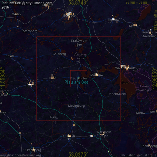
Analysis of Plau am See night lights 2016
Square area 10x10 km:
 0%
0%90-99
0%80-89
0%70-79
0%60-69
0%50-59
0%40-49
0.53%30-39
0%20-29
0%10-19
0%0-9
99.47%Square area 50x50 km:
0%90-99
0.03%80-89
0.01%70-79
0.04%60-69
0.03%50-59
0.07%40-49
0.08%30-39
0.02%20-29
0.06%10-19
0.02%0-9
99.64%Clear (daylight) street map image can be seen on geolist.org.
Map coordinates:
53° 52' 29.3" North, 11° 33' 33.6" East
53° 27' 29.6" North, 12° 15' 44.9" East
53° 2' 15" North, 12° 57' 56.1" East
Some cities around Plau am See sort by population:
• Güstrow
38.1 km =23.7 mi,  351°
351°
• Waren
28.5 km =17.7 mi,  75°
75°
• Parchim
27.6 km =17.1 mi,  262°
262°
• Wittstock
36.1 km =22.4 mi,  156°
156°
• Pritzwalk
34.8 km =21.6 mi,  189°
189°
• Malchow
10.7 km =6.6 mi, 80°
• Lübz
15.5 km =9.6 mi,  271°
271°
• Röbel
24.4 km =15.2 mi,  112°
112°
2853297 (p: 5,883)
Sources (retrieved 2019-11-25):
» Earth at Night: Flat Maps 2012, 2016