Nottuln night lights from space
Night Light of Nottuln (North Rhine-Westphalia) from space (Germany) Src. Average luminocity for 10x10km area is 2.3573% and for 50x50km: 5.6582%.
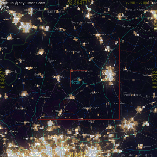
Analysis of Nottuln night lights 2016
Square area 10x10 km:
 0%
0%90-99
0%80-89
0%70-79
0.13%60-69
0.38%50-59
1.01%40-49
1.64%30-39
0.76%20-29
0.88%10-19
0.38%0-9
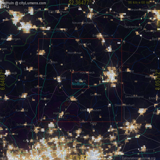
94.82%Square area 50x50 km:
0.64%90-99
0.78%80-89
0.35%70-79
0.62%60-69
0.92%50-59
0.95%40-49
1.11%30-39
0.87%20-29
1.12%10-19
3.15%0-9
89.49%Clear (daylight) street map image can be seen on geolist.org.
Map coordinates:
52° 21' 53.2" North, 6° 38' 48.7" East
51° 55' 60" North, 7° 21' 0" East
51° 29' 51.7" North, 8° 3' 11.2" East
Some cities around Nottuln sort by population:
• Dülmen
12.3 km =7.6 mi,  202°
202°
• Coesfeld
12.5 km =7.8 mi,  275°
275°
• Senden
12.5 km =7.8 mi,  133°
133°
• Havixbeck
7.2 km =4.5 mi,  39°
39°
• Billerbeck
6.4 km =4 mi,  321°
321°
• Altenberge
15.2 km =9.4 mi,  31°
31°
• Horstmar
16.7 km =10.4 mi,  349°
349°
• Laer
13.6 km =8.5 mi,  2°
2°
2861733 (p: 20,427)
Sources (retrieved 2019-11-25):
» Earth at Night: Flat Maps 2012, 2016