Havixbeck night lights from space
Night Light of Havixbeck (North Rhine-Westphalia) from space (Germany) Src. Average luminocity for 10x10km area is 0.5884% and for 50x50km: 5.3428%.
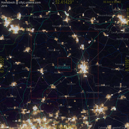
Analysis of Havixbeck night lights 2016
Square area 10x10 km:
 0%
0%90-99
0%80-89
0%70-79
0%60-69
0%50-59
0%40-49
0.63%30-39
0.25%20-29
0.13%10-19
0.38%0-9
98.61%Square area 50x50 km:
0.63%90-99
0.8%80-89
0.24%70-79
0.61%60-69
0.86%50-59
0.94%40-49
1.09%30-39
0.67%20-29
1.14%10-19
2.95%0-9
90.08%Clear (daylight) street map image can be seen on geolist.org.
Map coordinates:
52° 24' 51.4" North, 6° 42' 48.8" East
51° 58' 60" North, 7° 25' 0" East
51° 32' 53.5" North, 8° 7' 11.3" East
Some cities around Havixbeck sort by population:
• Münster
14.5 km =9 mi,  99°
99°
• Nottuln
7.2 km =4.5 mi,  219°
219°
• Senden
14.8 km =9.2 mi,  162°
162°
• Billerbeck
8.5 km =5.3 mi,  266°
266°
• Altenberge
8.2 km =5.1 mi,  24°
24°
• Nordwalde
12 km =7.5 mi, 22°
• Horstmar
13.3 km =8.3 mi,  324°
324°
• Laer
9 km =5.6 mi,  333°
333°
2908597 (p: 12,034)
Sources (retrieved 2019-11-25):
» Earth at Night: Flat Maps 2012, 2016