Neustadt an der Orla night lights from space
Night Light of Neustadt an der Orla (Thuringia) from space (Germany) Src. Average luminocity for 10x10km area is 1.2553% and for 50x50km: 3.4597%.
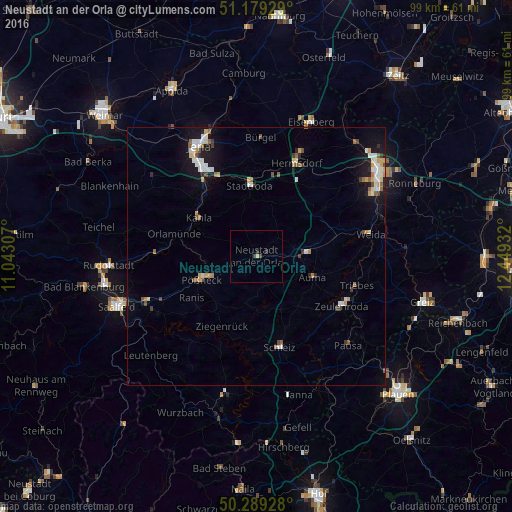
Analysis of Neustadt an der Orla night lights 2016
Square area 10x10 km:
 0%
0%90-99
0%80-89
0.53%70-79
0%60-69
0%50-59
0%40-49
0.67%30-39
0.4%20-29
1.07%10-19
0%0-9
97.33%Square area 50x50 km:
0.56%90-99
0.66%80-89
0.33%70-79
0.4%60-69
0.32%50-59
0.53%40-49
0.32%30-39
0.32%20-29
0.39%10-19
2.53%0-9
93.65%Clear (daylight) street map image can be seen on geolist.org.
Map coordinates:
51° 10' 45.4" North, 11° 2' 35.1" East
50° 44' 11" North, 11° 44' 46.3" East
50° 17' 21.4" North, 12° 26' 57.6" East
Some cities around Neustadt an der Orla sort by population:
• Jena
24 km =14.9 mi,  332°
332°
• Zeulenroda
19.1 km =11.9 mi,  119°
119°
• Pößneck
11.8 km =7.3 mi,  246°
246°
• Schleiz
18.1 km =11.2 mi,  165°
165°
• Weida
22.5 km =14 mi,  79°
79°
• Hermsdorf
19.4 km =12.1 mi,  23°
23°
• Kahla
13.7 km =8.5 mi,  304°
304°
• Stadtroda
13.5 km =8.4 mi,  354°
354°
8354429 (p: 7,282)
Sources (retrieved 2019-11-25):
» Earth at Night: Flat Maps 2012, 2016