Neunkirchen am Brand night lights from space
Night Light of Neunkirchen am Brand (Bavaria) from space (Germany) Src. Average luminocity for 10x10km area is 6.9062% and for 50x50km: 12.893%.
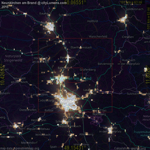
Analysis of Neunkirchen am Brand night lights 2016
Square area 10x10 km:
 0%
0%90-99
0.28%80-89
0.56%70-79
0.56%60-69
1.12%50-59
1.54%40-49
1.4%30-39
2.66%20-29
0%10-19
5.04%0-9
86.83%Square area 50x50 km:
2.76%90-99
2.35%80-89
1.08%70-79
1.07%60-69
1.51%50-59
1.77%40-49
1.89%30-39
1.84%20-29
3.7%10-19
5.89%0-9
76.13%Clear (daylight) street map image can be seen on geolist.org.
Map coordinates:
50° 3' 55.8" North, 10° 25' 35.6" East
49° 36' 43.3" North, 11° 7' 46.8" East
49° 9' 15.5" North, 11° 49' 58.1" East
Some cities around Neunkirchen am Brand sort by population:
• Erlangen
9.1 km =5.7 mi,  255°
255°
• Forchheim
12.8 km =8 mi,  336°
336°
• Lauf an der Pegnitz
15.5 km =9.6 mi,  134°
134°
• Röthenbach an der Pegnitz
16.4 km =10.2 mi,  150°
150°
• Heroldsberg
9 km =5.6 mi,  168°
168°
• Baiersdorf
8.5 km =5.3 mi,  307°
307°
• Hemhofen
16.2 km =10.1 mi,  299°
299°
• Heroldsbach
13.1 km =8.1 mi, 313°
6694210 (p: 8,243)
Sources (retrieved 2019-11-25):
» Earth at Night: Flat Maps 2012, 2016