Hemhofen night lights from space
Night Light of Hemhofen (Bavaria) from space (Germany) Src. Average luminocity for 10x10km area is 5.1578% and for 50x50km: 9.5699%.
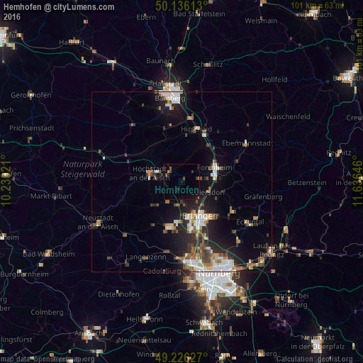
Analysis of Hemhofen night lights 2016
Square area 10x10 km:
 0%
0%90-99
0%80-89
0%70-79
0.53%60-69
1.07%50-59
1.07%40-49
1.07%30-39
1.07%20-29
1.6%10-19
4.28%0-9
89.3%Square area 50x50 km:
1.55%90-99
1.57%80-89
0.94%70-79
0.79%60-69
1.15%50-59
1.31%40-49
1.63%30-39
1.32%20-29
3.18%10-19
5.94%0-9
80.63%Clear (daylight) street map image can be seen on geolist.org.
Map coordinates:
50° 8' 10.1" North, 10° 13' 48.8" East
49° 40' 60" North, 10° 55' 60" East
49° 13' 34.6" North, 11° 38' 11.3" East
Some cities around Hemhofen sort by population:
• Erlangen
11.6 km =7.2 mi,  152°
152°
• Forchheim
9.8 km =6.1 mi,  67°
67°
• Herzogenaurach
13.3 km =8.3 mi,  194°
194°
• Höchstadt an der Aisch
9 km =5.6 mi,  286°
286°
• Baiersdorf
7.9 km =4.9 mi,  110°
110°
• Eggolsheim
13.1 km =8.1 mi,  42°
42°
• Weisendorf
10.3 km =6.4 mi,  229°
229°
• Heroldsbach
4.8 km =3 mi,  76°
76°
2906583 (p: 5,322)
Sources (retrieved 2019-11-25):
» Earth at Night: Flat Maps 2012, 2016