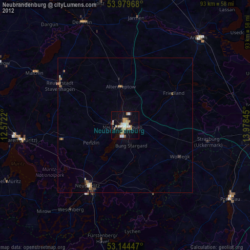
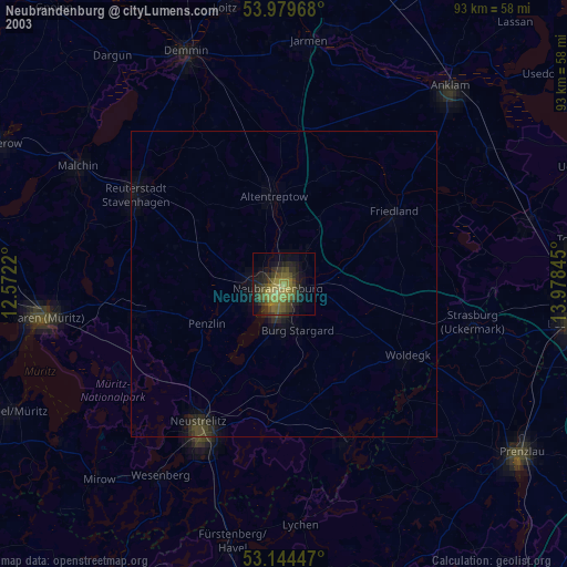
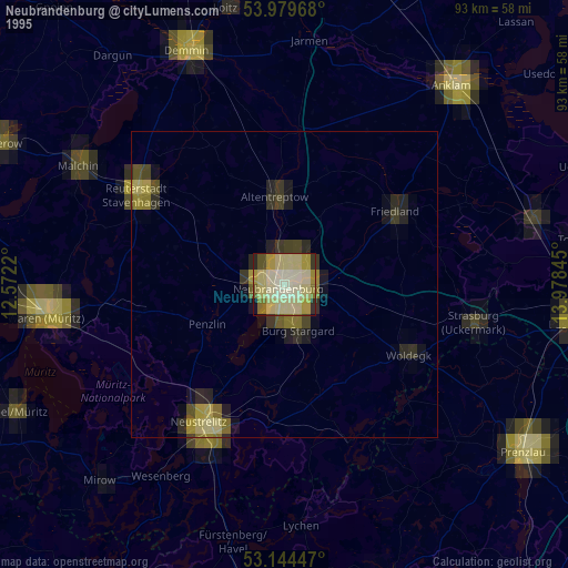
Neubrandenburg night lights from space
Night Light of Neubrandenburg (Mecklenburg-Vorpommern) from space (Germany) Src. Average luminocity for 10x10km area is 24.971% and for 50x50km: 1.5163%.

Analysis of Neubrandenburg night lights 2016
Square area 10x10 km:
 5.56%
5.56%90-99
4.55%80-89
1.77%70-79
3.54%60-69
4.29%50-59
1.39%40-49
1.52%30-39
0.38%20-29
1.39%10-19
30.56%0-9
45.08%Square area 50x50 km:
0.25%90-99
0.24%80-89
0.12%70-79
0.21%60-69
0.26%50-59
0.17%40-49
0.12%30-39
0.03%20-29
0.15%10-19
1.32%0-9
97.12%Clear (daylight) street map image can be seen on geolist.org.
Map coordinates:
53° 58' 46.8" North, 12° 34' 19.9" East
53° 33' 50.9" North, 13° 16' 31.2" East
53° 8' 40.1" North, 13° 58' 42.4" East
Some cities around Neubrandenburg sort by population:
• Neustrelitz
26.2 km =16.3 mi,  210°
210°
• Waren
39.6 km =24.6 mi,  262°
262°
• Demmin
41.4 km =25.7 mi,  337°
337°
• Malchin
38.9 km =24.2 mi,  300°
300°
• Friedland
21.8 km =13.5 mi,  57°
57°
• Altentreptow
14.5 km =9 mi,  357°
357°
• Strasburg
31.6 km =19.6 mi,  100°
100°
• Alt-Sanitz
34.5 km =21.4 mi,  36°
36°
2866135 (p: 68,082)
Sources (retrieved 2019-11-25):
» NASA, Earths city lights 1995
» NASA city lights 2003
» Earth at Night: Flat Maps 2012, 2016