Malchin night lights from space
Night Light of Malchin (Mecklenburg-Vorpommern) from space (Germany) Src. Average luminocity for 10x10km area is 1.1578% and for 50x50km: 0.4655%.
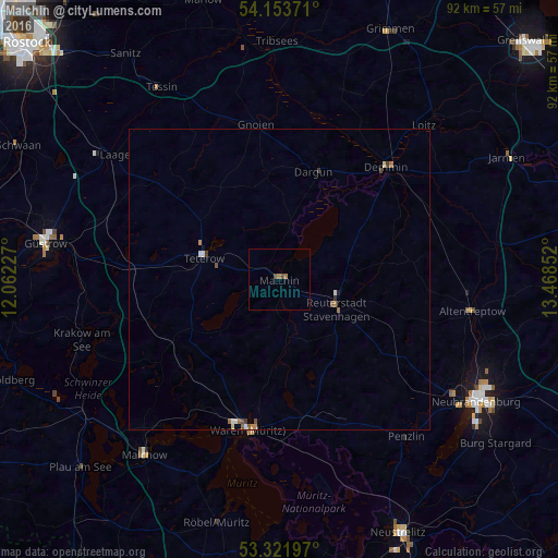
Analysis of Malchin night lights 2016
Square area 10x10 km:
 0%
0%90-99
0%80-89
0%70-79
0%60-69
1.01%50-59
0%40-49
1.01%30-39
0%20-29
0%10-19
0%0-9
97.98%Square area 50x50 km:
0.03%90-99
0.09%80-89
0.04%70-79
0.02%60-69
0.15%50-59
0.1%40-49
0.12%30-39
0.09%20-29
0.01%10-19
0.03%0-9
99.32%Clear (daylight) street map image can be seen on geolist.org.
Map coordinates:
54° 9' 13.4" North, 12° 3' 44.2" East
53° 44' 23.6" North, 12° 45' 55.4" East
53° 19' 19.1" North, 13° 28' 6.7" East
Some cities around Malchin sort by population:
• Neubrandenburg
38.9 km =24.2 mi,  120°
120°
• Güstrow
39.4 km =24.5 mi,  279°
279°
• Waren
25 km =15.5 mi,  193°
193°
• Demmin
25.5 km =15.8 mi,  43°
43°
• Grimmen
45.1 km =28 mi,  23°
23°
• Teterow
13.1 km =8.1 mi,  287°
287°
• Altentreptow
33.3 km =20.7 mi,  98°
98°
• Röbel
41.9 km =26 mi, 194°
2874131 (p: 8,202)
Sources (retrieved 2019-11-25):
» Earth at Night: Flat Maps 2012, 2016