Altentreptow night lights from space
Night Light of Altentreptow (Mecklenburg-Vorpommern) from space (Germany) Src. Average luminocity for 10x10km area is 1.0076% and for 50x50km: 1.302%.
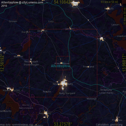
Analysis of Altentreptow night lights 2016
Square area 10x10 km:
 0%
0%90-99
0%80-89
0%70-79
0.51%60-69
0%50-59
0.51%40-49
0.51%30-39
0%20-29
0.51%10-19
0%0-9
97.98%Square area 50x50 km:
0.22%90-99
0.2%80-89
0.1%70-79
0.17%60-69
0.25%50-59
0.11%40-49
0.1%30-39
0.05%20-29
0.13%10-19
1.32%0-9
97.33%Clear (daylight) street map image can be seen on geolist.org.
Map coordinates:
54° 6' 30.3" North, 12° 33' 42.9" East
53° 41' 39" North, 13° 15' 54.1" East
53° 16' 32.8" North, 13° 58' 5.4" East
Some cities around Altentreptow sort by population:
• Neubrandenburg
14.5 km =9 mi,  177°
177°
• Neustrelitz
39.1 km =24.3 mi,  198°
198°
• Anklam
33.2 km =20.6 mi,  57°
57°
• Demmin
28.3 km =17.6 mi,  327°
327°
• Malchin
33.3 km =20.7 mi,  278°
278°
• Friedland
19.2 km =11.9 mi,  97°
97°
• Strasburg
37.7 km =23.4 mi,  122°
122°
• Alt-Sanitz
25 km =15.5 mi, 57°
2957437 (p: 6,486)
Sources (retrieved 2019-11-25):
» Earth at Night: Flat Maps 2012, 2016