Murnau am Staffelsee night lights from space
Night Light of Murnau am Staffelsee (Bavaria) from space (Germany) Src. Average luminocity for 10x10km area is 1.317% and for 50x50km: 1.4789%.
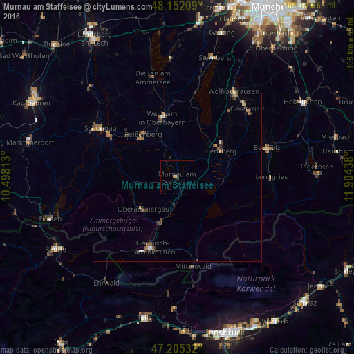
Analysis of Murnau am Staffelsee night lights 2016
Square area 10x10 km:
 0%
0%90-99
0%80-89
0%70-79
0.6%60-69
0.6%50-59
0%40-49
0%30-39
0%20-29
1.19%10-19
0.6%0-9
97.02%Square area 50x50 km:
0.07%90-99
0.11%80-89
0.09%70-79
0.18%60-69
0.41%50-59
0.43%40-49
0.29%30-39
0.25%20-29
0.37%10-19
0.15%0-9
97.64%Clear (daylight) street map image can be seen on geolist.org.
Map coordinates:
48° 9' 7.5" North, 10° 29' 53.3" East
47° 40' 51.1" North, 11° 12' 4.5" East
47° 12' 19.2" North, 11° 54' 15.8" East
Some cities around Murnau am Staffelsee sort by population:
• Garmisch-Partenkirchen
22.4 km =13.9 mi,  200°
200°
• Weilheim
18.2 km =11.3 mi,  349°
349°
• Penzberg
15.4 km =9.6 mi,  58°
58°
• Peißenberg
16.9 km =10.5 mi,  324°
324°
• Peiting
24 km =14.9 mi,  302°
302°
• Tutzing
26.1 km =16.2 mi,  13°
13°
• Mittenwald
26.9 km =16.7 mi,  170°
170°
• Oberammergau
13.6 km =8.5 mi,  227°
227°
2867445 (p: 11,958)
Sources (retrieved 2019-11-25):
» Earth at Night: Flat Maps 2012, 2016