Marsberg night lights from space
Night Light of Marsberg (North Rhine-Westphalia) from space (Germany) Src. Average luminocity for 10x10km area is 0.6805% and for 50x50km: 1.4616%.
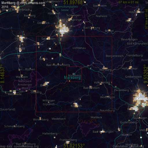

Analysis of Marsberg night lights 2016
Square area 10x10 km:
 0%
0%90-99
0%80-89
0%70-79
0%60-69
0.53%50-59
0%40-49
0.13%30-39
0.4%20-29
0.53%10-19
0%0-9
98.4%Square area 50x50 km:
0.11%90-99
0.11%80-89
0.07%70-79
0.2%60-69
0.28%50-59
0.45%40-49
0.28%30-39
0.31%20-29
0.11%10-19
0.63%0-9
97.46%Clear (daylight) street map image can be seen on geolist.org.
Map coordinates:
51° 53' 51.6" North, 8° 8' 46.9" East
51° 27' 42.2" North, 8° 50' 58.2" East
51° 1' 17.5" North, 9° 33' 9.4" East
Some cities around Marsberg sort by population:
• Brilon
20.7 km =12.9 mi,  248°
248°
• Korbach
20.8 km =12.9 mi,  175°
175°
• Warburg
20.8 km =12.9 mi,  81°
81°
• Bad Arolsen
14.6 km =9.1 mi,  128°
128°
• Wünnenberg
12.3 km =7.6 mi,  301°
301°
• Lichtenau
17.6 km =10.9 mi,  10°
10°
• Willebadessen
22.4 km =13.9 mi,  35°
35°
• Volkmarsen
19.5 km =12.1 mi,  107°
107°
2873211 (p: 21,914)
Sources (retrieved 2019-11-25):
» Earth at Night: Flat Maps 2012, 2016