Korbach night lights from space
Night Light of Korbach (Hesse) from space (Germany) Src. Average luminocity for 10x10km area is 6.5448% and for 50x50km: 1.1256%.
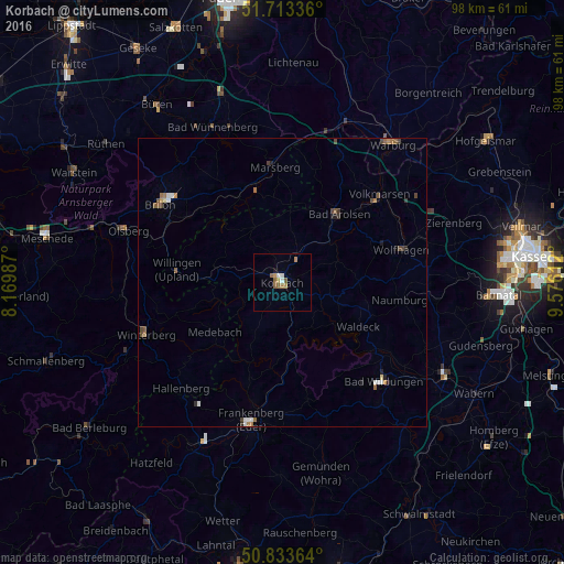
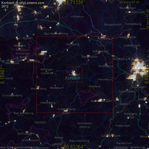
Analysis of Korbach night lights 2016
Square area 10x10 km:
 0.84%
0.84%90-99
0.84%80-89
0.14%70-79
1.26%60-69
1.68%50-59
2.24%40-49
0.28%30-39
0%20-29
0%10-19
0.56%0-9
92.16%Square area 50x50 km:
0.15%90-99
0.15%80-89
0.05%70-79
0.12%60-69
0.23%50-59
0.3%40-49
0.23%30-39
0.15%20-29
0.16%10-19
0.09%0-9
98.37%Clear (daylight) street map image can be seen on geolist.org.
Map coordinates:
51° 42' 48.1" North, 8° 10' 11.5" East
51° 16' 32.2" North, 8° 52' 22.8" East
50° 50' 1.1" North, 9° 34' 34" East
Some cities around Korbach sort by population:
• Marsberg
20.8 km =12.9 mi,  355°
355°
• Bad Arolsen
15.2 km =9.4 mi,  40°
40°
• Wolfhagen
21.4 km =13.3 mi,  74°
74°
• Medebach
14.5 km =9 mi,  233°
233°
• Waldeck
15.3 km =9.5 mi,  120°
120°
• Willingen
18.5 km =11.5 mi,  276°
276°
• Vöhl
9.3 km =5.8 mi,  147°
147°
• Naumburg
20.6 km =12.8 mi,  98°
98°
2885536 (p: 24,481)
Sources (retrieved 2019-11-25):
» Earth at Night: Flat Maps 2012, 2016