Mallersdorf-Pfaffenberg night lights from space
Night Light of Mallersdorf-Pfaffenberg (Bavaria) from space (Germany) Src. Average luminocity for 10x10km area is 1.2088% and for 50x50km: 3.9481%.
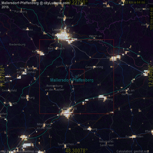
Analysis of Mallersdorf-Pfaffenberg night lights 2016
Square area 10x10 km:
 0%
0%90-99
0%80-89
0%70-79
0.57%60-69
0%50-59
0%40-49
0%30-39
0.85%20-29
0.85%10-19
1.14%0-9
96.59%Square area 50x50 km:
0.6%90-99
0.84%80-89
0.28%70-79
0.32%60-69
0.34%50-59
0.44%40-49
0.43%30-39
0.35%20-29
1.12%10-19
2.89%0-9
92.39%Clear (daylight) street map image can be seen on geolist.org.
Map coordinates:
49° 13' 39.6" North, 11° 31' 40.2" East
48° 45' 58.9" North, 12° 13' 51.5" East
48° 18' 2.8" North, 12° 56' 2.7" East
Some cities around Mallersdorf-Pfaffenberg sort by population:
• Ergolding
21.6 km =13.4 mi,  191°
191°
• Essenbach
17 km =10.6 mi,  183°
183°
• Rottenburg an der Laaber
16.6 km =10.3 mi,  244°
244°
• Ergoldsbach
8.4 km =5.2 mi, 193°
• Schierling
10.1 km =6.3 mi,  318°
318°
• Geiselhöring
13.8 km =8.6 mi,  61°
61°
• Mengkofen
16.2 km =10.1 mi,  108°
108°
• Langquaid
14.6 km =9.1 mi,  295°
295°
3206682 (p: 6,742)
Sources (retrieved 2019-11-25):
» Earth at Night: Flat Maps 2012, 2016