Schierling night lights from space
Night Light of Schierling (Bavaria) from space (Germany) Src. Average luminocity for 10x10km area is 0.3778% and for 50x50km: 4.7793%.
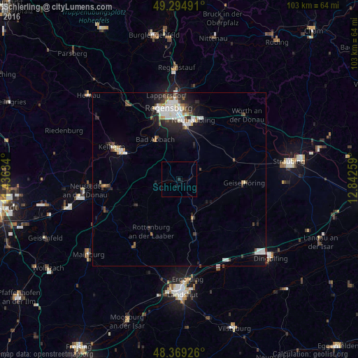
Analysis of Schierling night lights 2016
Square area 10x10 km:
 0%
0%90-99
0%80-89
0%70-79
0%60-69
0%50-59
0%40-49
0%30-39
0%20-29
0.57%10-19
0.85%0-9
98.58%Square area 50x50 km:
1%90-99
1.1%80-89
0.3%70-79
0.3%60-69
0.34%50-59
0.43%40-49
0.67%30-39
0.55%20-29
1.52%10-19
2.77%0-9
91%Clear (daylight) street map image can be seen on geolist.org.
Map coordinates:
49° 17' 41.7" North, 11° 26' 10.8" East
48° 50' 3.2" North, 12° 8' 22.1" East
48° 22' 9.3" North, 12° 50' 33.3" East
Some cities around Schierling sort by population:
• Neutraubling
17.6 km =10.9 mi,  14°
14°
• Bad Abbach
13.4 km =8.3 mi,  328°
328°
• Rottenburg an der Laaber
16.8 km =10.4 mi,  209°
209°
• Ergoldsbach
16.4 km =10.2 mi,  163°
163°
• Obertraubling
14.9 km =9.3 mi, 7°
• Mallersdorf-Pfaffenberg
10.1 km =6.3 mi,  138°
138°
• Saal
16.9 km =10.5 mi,  296°
296°
• Langquaid
6.6 km =4.1 mi,  259°
259°
2839393 (p: 7,347)
Sources (retrieved 2019-11-25):
» Earth at Night: Flat Maps 2012, 2016