Mainaschaff night lights from space
Night Light of Mainaschaff (Bavaria) from space (Germany) Src. Average luminocity for 10x10km area is 32.6583% and for 50x50km: 11.9305%.
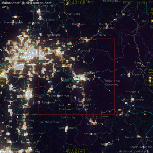
Analysis of Mainaschaff night lights 2016
Square area 10x10 km:
 5.88%
5.88%90-99
7.98%80-89
3.22%70-79
1.12%60-69
2.8%50-59
2.94%40-49
4.76%30-39
2.66%20-29
8.4%10-19
43.98%0-9
16.25%Square area 50x50 km:
1.48%90-99
1.9%80-89
1.09%70-79
1.22%60-69
1.96%50-59
1.4%40-49
1.39%30-39
1.84%20-29
4.23%10-19
10.39%0-9
73.1%Clear (daylight) street map image can be seen on geolist.org.
Map coordinates:
50° 25' 54" North, 8° 23' 12.8" East
49° 58' 54" North, 9° 5' 24" East
49° 31' 38.7" North, 9° 47' 35.3" East
Some cities around Mainaschaff sort by population:
• Aschaffenburg
4.5 km =2.8 mi,  96°
96°
• Großostheim
6.9 km =4.3 mi,  188°
188°
• Hösbach
8.8 km =5.5 mi,  71°
71°
• Goldbach
7 km =4.3 mi, 73°
• Schaafheim
8.6 km =5.3 mi,  222°
222°
• Haibach
8.6 km =5.3 mi, 102°
• Kleinostheim
2.6 km =1.6 mi,  320°
320°
• Stockstadt am Main
1.8 km =1.1 mi,  225°
225°
2874263 (p: 8,382)
Sources (retrieved 2019-11-25):
» Earth at Night: Flat Maps 2012, 2016