Hösbach night lights from space
Night Light of Hösbach (Bavaria) from space (Germany) Src. Average luminocity for 10x10km area is 17.4762% and for 50x50km: 7.9403%.
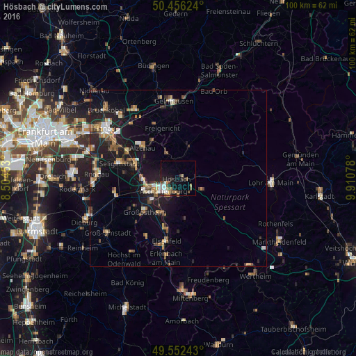
Analysis of Hösbach night lights 2016
Square area 10x10 km:
 2.8%
2.8%90-99
3.36%80-89
1.26%70-79
1.54%60-69
2.66%50-59
2.52%40-49
2.24%30-39
2.1%20-29
2.8%10-19
13.45%0-9
65.27%Square area 50x50 km:
0.72%90-99
1.02%80-89
0.74%70-79
0.86%60-69
1.46%50-59
1.12%40-49
1.05%30-39
0.87%20-29
2.45%10-19
7.81%0-9
81.89%Clear (daylight) street map image can be seen on geolist.org.
Map coordinates:
50° 27' 22.5" North, 8° 30' 16.3" East
50° 0' 23.3" North, 9° 12' 27.5" East
49° 33' 8.7" North, 9° 54' 38.8" East
Some cities around Hösbach sort by population:
• Aschaffenburg
5.1 km =3.2 mi,  230°
230°
• Mömbris
7.7 km =4.8 mi,  335°
335°
• Goldbach
1.8 km =1.1 mi,  245°
245°
• Haibach
4.7 km =2.9 mi,  180°
180°
• Kleinostheim
10.1 km =6.3 mi,  265°
265°
• Mainaschaff
8.8 km =5.5 mi, 251°
• Stockstadt am Main
10.5 km =6.5 mi, 247°
• Laufach
6.7 km =4.2 mi,  80°
80°
2898494 (p: 13,203)
Sources (retrieved 2019-11-25):
» Earth at Night: Flat Maps 2012, 2016