Mahlsdorf night lights from space
Night Light of Mahlsdorf (Berlin) from space (Germany) Src. Average luminocity for 10x10km area is 64.5251% and for 50x50km: 30.9298%.
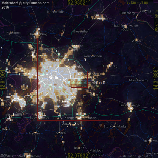
Analysis of Mahlsdorf night lights 2016
Square area 10x10 km:
 14.42%
90-99
18.12%80-89
10.05%70-79
10.19%60-69
7.8%50-59
6.61%40-49
4.1%30-39
4.1%20-29
11.24%10-19
13.36%0-9
0%Square area 50x50 km:
9.87%90-99
7.98%80-89
2.87%70-79
2.41%60-69
2.39%50-59
2.6%40-49
3.52%30-39
3.4%20-29
4.85%10-19
10.14%0-9
49.96%Clear (daylight) street map image can be seen on geolist.org.
Map coordinates:
52° 56' 6.8" North, 12° 54' 38.2" East
52° 30' 33.7" North, 13° 36' 49.4" East
52° 4' 45.6" North, 14° 19' 0.7" East
Some cities around Mahlsdorf sort by population:
• Marzahn
5 km =3.1 mi,  323°
323°
• Hellersdorf
2.7 km =1.7 mi,  352°
352°
• Biesdorf
4.1 km =2.5 mi,  269°
269°
• Karlshorst
6.2 km =3.9 mi,  243°
243°
• Kaulsdorf
1.9 km =1.2 mi,  297°
297°
• Friedrichshagen
6.6 km =4.1 mi,  173°
173°
• Neuenhagen
5.6 km =3.5 mi,  65°
65°
• Schöneiche
6.7 km =4.2 mi,  127°
127°
2874455 (p: 26,954)
Sources (retrieved 2019-11-25):
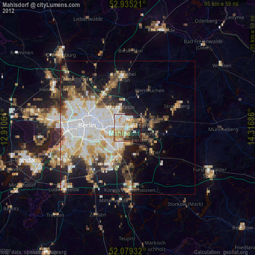
» Earth at Night: Flat Maps 2012, 2016