Biesdorf night lights from space
Night Light of Biesdorf (Berlin) from space (Germany) Src. Average luminocity for 10x10km area is 87.7063% and for 50x50km: 34.3616%.
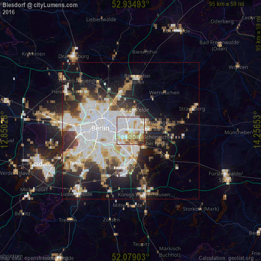
Analysis of Biesdorf night lights 2016
Square area 10x10 km:
 33.86%
90-99
28.97%80-89
11.24%70-79
11.51%60-69
5.03%50-59
4.76%40-49
2.12%30-39
2.25%20-29
0.26%10-19
0%0-9
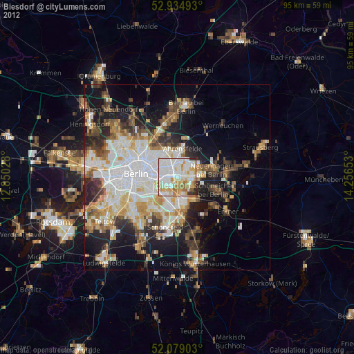
0%Square area 50x50 km:
10.39%90-99
8.72%80-89
3.24%70-79
2.79%60-69
2.86%50-59
2.95%40-49
3.9%30-39
4.18%20-29
6.31%10-19
12.12%0-9
42.54%Clear (daylight) street map image can be seen on geolist.org.
Map coordinates:
52° 56' 5.7" North, 12° 51' 1" East
52° 30' 32.6" North, 13° 33' 12.2" East
52° 4' 44.5" North, 14° 15' 23.5" East
Some cities around Biesdorf sort by population:
• Marzahn
4.2 km =2.6 mi,  15°
15°
• Hellersdorf
4.6 km =2.9 mi,  54°
54°
• Friedrichsfelde
3.1 km =1.9 mi,  263°
263°
• Lichtenberg
3.7 km =2.3 mi,  278°
278°
• Mahlsdorf
4.1 km =2.5 mi,  89°
89°
• Karlshorst
3.1 km =1.9 mi,  207°
207°
• Rummelsburg
4.1 km =2.5 mi, 258°
• Kaulsdorf
2.6 km =1.6 mi,  68°
68°
2949073 (p: 24,988)
Sources (retrieved 2019-11-25):
» Earth at Night: Flat Maps 2012, 2016