Machern night lights from space
Night Light of Machern (Saxony) from space (Germany) Src. Average luminocity for 10x10km area is 1.9902% and for 50x50km: 8.9326%.
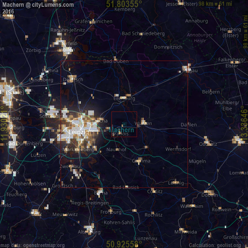
Analysis of Machern night lights 2016
Square area 10x10 km:
 0%
0%90-99
0%80-89
0%70-79
0.56%60-69
0.56%50-59
0%40-49
0.7%30-39
0.98%20-29
1.12%10-19
0%0-9
96.08%Square area 50x50 km:
1.62%90-99
1.9%80-89
0.93%70-79
0.92%60-69
1.12%50-59
1.06%40-49
1.1%30-39
1.49%20-29
1.96%10-19
3.85%0-9
84.06%Clear (daylight) street map image can be seen on geolist.org.
Map coordinates:
51° 48' 12.8" North, 11° 55' 48.8" East
51° 22' 0" North, 12° 37' 60" East
50° 55' 32.1" North, 13° 20' 11.3" East
Some cities around Machern sort by population:
• Eilenburg
10.4 km =6.5 mi,  0°
0°
• Wurzen
7.4 km =4.6 mi,  86°
86°
• Taucha
10.6 km =6.6 mi,  280°
280°
• Brandis
3.8 km =2.4 mi,  205°
205°
• Naunhof
10.4 km =6.5 mi,  197°
197°
• Borsdorf
7.2 km =4.5 mi,  255°
255°
• Großpösna
14.5 km =9 mi,  219°
219°
• Bennewitz
5.6 km =3.5 mi,  96°
96°
2874642 (p: 6,747)
Sources (retrieved 2019-11-25):
» Earth at Night: Flat Maps 2012, 2016