Lemsahl-Mellingstedt night lights from space
Night Light of Lemsahl-Mellingstedt (Hamburg) from space (Germany) Src. Average luminocity for 10x10km area is 33.1162% and for 50x50km: 22.6671%.
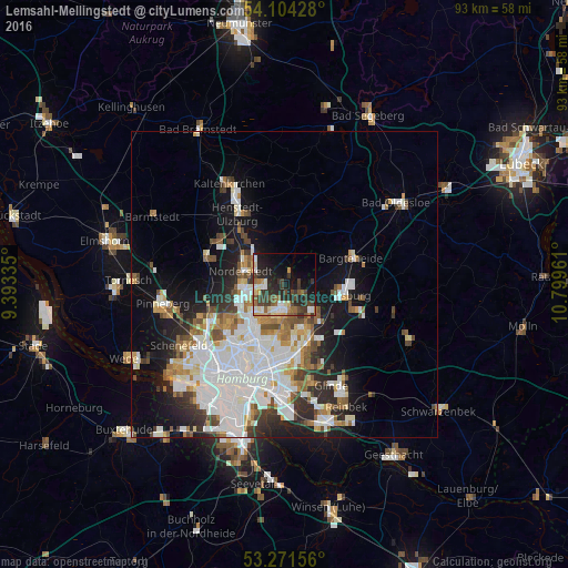
Analysis of Lemsahl-Mellingstedt night lights 2016
Square area 10x10 km:
 3.54%
3.54%90-99
6.06%80-89
3.28%70-79
3.41%60-69
3.91%50-59
3.79%40-49
7.45%30-39
9.97%20-29
14.14%10-19
19.19%0-9
25.25%Square area 50x50 km:
7.03%90-99
5.22%80-89
1.55%70-79
1.88%60-69
2.44%50-59
2.1%40-49
2.45%30-39
2.35%20-29
4.09%10-19
9.62%0-9
61.28%Clear (daylight) street map image can be seen on geolist.org.
Map coordinates:
54° 6' 15.4" North, 9° 23' 36.1" East
53° 41' 23.9" North, 10° 5' 47.3" East
53° 16' 17.6" North, 10° 47' 58.6" East
Some cities around Lemsahl-Mellingstedt sort by population:
• Langenhorn
5.9 km =3.7 mi,  243°
243°
• Sasel
4.1 km =2.5 mi,  165°
165°
• Poppenbüttel
3.5 km =2.2 mi,  192°
192°
• Hummelsbüttel
5.9 km =3.7 mi,  217°
217°
• Wellingsbüttel
5.6 km =3.5 mi, 191°
• Bergstedt
2.9 km =1.8 mi,  136°
136°
• Duvenstedt
2.1 km =1.3 mi,  14°
14°
• Tangstedt
4.9 km =3 mi,  349°
349°
2878918 (p: 6,554)
Sources (retrieved 2019-11-25):
» Earth at Night: Flat Maps 2012, 2016