Boizenburg night lights from space
Night Light of Boizenburg (Mecklenburg-Vorpommern) from space (Germany) Src. Average luminocity for 10x10km area is 1.7143% and for 50x50km: 1.906%.
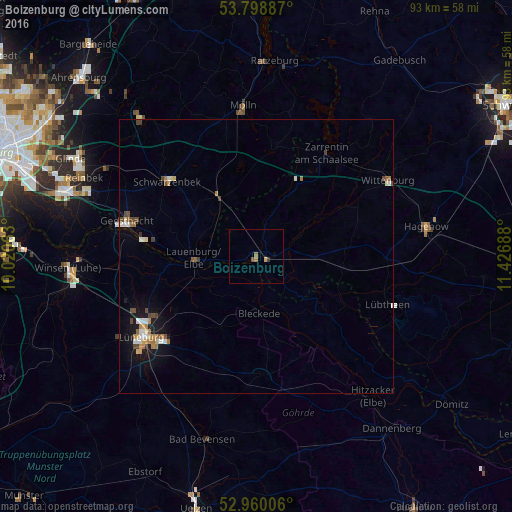
Analysis of Boizenburg night lights 2016
Square area 10x10 km:
 0%
0%90-99
0%80-89
0.26%70-79
0.26%60-69
1.06%50-59
0.26%40-49
0.26%30-39
0.53%20-29
0%10-19
0%0-9
97.35%Square area 50x50 km:
0.24%90-99
0.28%80-89
0.22%70-79
0.18%60-69
0.38%50-59
0.17%40-49
0.44%30-39
0.18%20-29
0.01%10-19
1.36%0-9
96.53%Clear (daylight) street map image can be seen on geolist.org.
Map coordinates:
53° 47' 55.9" North, 10° 1' 14.3" East
53° 22' 53.5" North, 10° 43' 25.5" East
52° 57' 36.2" North, 11° 25' 36.8" East
Some cities around Boizenburg sort by population:
• Lüneburg
25.2 km =15.7 mi,  234°
234°
• Geesthacht
23.7 km =14.7 mi,  284°
284°
• Schwarzenbek
21 km =13 mi,  309°
309°
• Lauenburg
11.1 km =6.9 mi,  264°
264°
• Adendorf
22 km =13.7 mi,  239°
239°
• Bleckede
10.2 km =6.3 mi,  176°
176°
• Bardowick
24.3 km =15.1 mi,  246°
246°
• Büchen
13 km =8.1 mi,  327°
327°
2946821 (p: 10,783)
Sources (retrieved 2019-11-25):
» Earth at Night: Flat Maps 2012, 2016