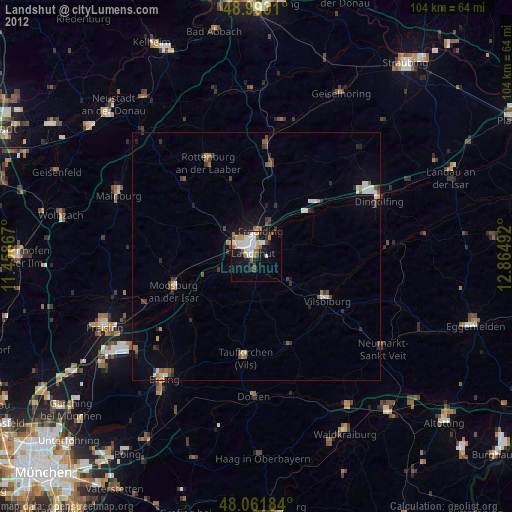
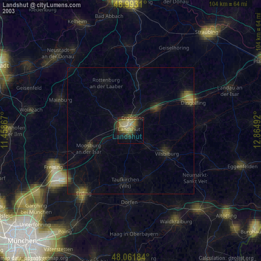
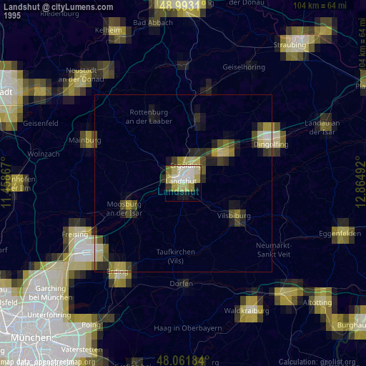
Landshut night lights from space
Night Light of Landshut (Bavaria) from space (Germany) Src. Average luminocity for 10x10km area is 32.6591% and for 50x50km: 3.6655%.
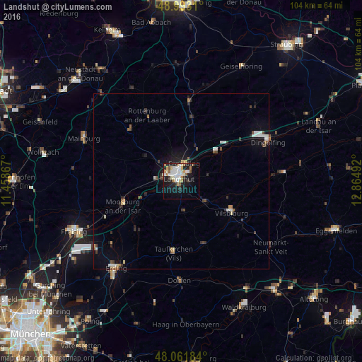
Analysis of Landshut night lights 2016
Square area 10x10 km:
 6.25%
6.25%90-99
9.52%80-89
2.41%70-79
4.12%60-69
2.7%50-59
4.55%40-49
0.14%30-39
2.27%20-29
7.53%10-19
25.85%0-9
34.66%Square area 50x50 km:
0.53%90-99
0.75%80-89
0.28%70-79
0.37%60-69
0.34%50-59
0.35%40-49
0.42%30-39
0.52%20-29
0.77%10-19
2.39%0-9
93.28%Clear (daylight) street map image can be seen on geolist.org.
Map coordinates:
48° 59' 35.2" North, 11° 27' 31.2" East
48° 31' 46.6" North, 12° 9' 42.4" East
48° 3' 42.6" North, 12° 51' 53.7" East
Some cities around Landshut sort by population:
• Moosburg
17.7 km =11 mi,  248°
248°
• Ergolding
5.3 km =3.3 mi,  7°
7°
• Vilsbiburg
16.7 km =10.4 mi,  120°
120°
• Essenbach
10.2 km =6.3 mi,  24°
24°
• Ergoldsbach
18.4 km =11.4 mi, 9°
• Velden
19.4 km =12.1 mi,  159°
159°
• Geisenhausen
9.3 km =5.8 mi,  129°
129°
• Bruckberg
12.3 km =7.6 mi,  266°
266°
2881485 (p: 60,488)
Sources (retrieved 2019-11-25):
» NASA, Earths city lights 1995
» NASA city lights 2003
» Earth at Night: Flat Maps 2012, 2016