Kronshagen night lights from space
Night Light of Kronshagen (Schleswig-Holstein) from space (Germany) Src. Average luminocity for 10x10km area is 46.4198% and for 50x50km: 4.6072%.
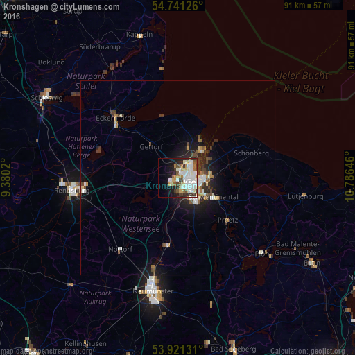
Analysis of Kronshagen night lights 2016
Square area 10x10 km:
 12.41%
90-99
14.16%80-89
4.51%70-79
5.14%60-69
3.76%50-59
4.26%40-49
3.38%30-39
6.77%20-29
6.02%10-19
12.28%0-9
27.32%Square area 50x50 km:
0.76%90-99
0.96%80-89
0.44%70-79
0.42%60-69
0.45%50-59
0.48%40-49
0.66%30-39
0.79%20-29
1.14%10-19
2.99%0-9
90.91%Clear (daylight) street map image can be seen on geolist.org.
Map coordinates:
54° 44' 28.5" North, 9° 22' 48.7" East
54° 19' 60" North, 10° 4' 60" East
53° 55' 16.7" North, 10° 47' 11.3" East
Some cities around Kronshagen sort by population:
• Kiel
3.6 km =2.2 mi,  111°
111°
• Altenholz
8.1 km =5 mi,  23°
23°
• Heikendorf
8.4 km =5.2 mi,  63°
63°
• Flintbek
9.3 km =5.8 mi,  186°
186°
• Schönkirchen
9.7 km =6 mi,  90°
90°
• Gettorf
9.8 km =6.1 mi,  318°
318°
• Klausdorf
8.9 km =5.5 mi, 107°
• Laboe
11.4 km =7.1 mi,  49°
49°
2883647 (p: 11,856)
Sources (retrieved 2019-11-25):
» Earth at Night: Flat Maps 2012, 2016