Flintbek night lights from space
Night Light of Flintbek (Schleswig-Holstein) from space (Germany) Src. Average luminocity for 10x10km area is 5.8697% and for 50x50km: 5.9324%.
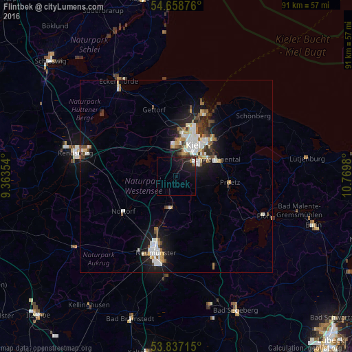
Analysis of Flintbek night lights 2016
Square area 10x10 km:
 0.38%
0.38%90-99
0.63%80-89
0%70-79
0%60-69
0.5%50-59
1%40-49
0.38%30-39
0.88%20-29
4.39%10-19
11.28%0-9
80.58%Square area 50x50 km:
1.12%90-99
1.29%80-89
0.58%70-79
0.52%60-69
0.56%50-59
0.59%40-49
0.73%30-39
0.72%20-29
1.35%10-19
4.4%0-9
88.15%Clear (daylight) street map image can be seen on geolist.org.
Map coordinates:
54° 39' 31.5" North, 9° 21' 48.7" East
54° 15' 0" North, 10° 4' 0" East
53° 50' 13.7" North, 10° 46' 11.3" East
Some cities around Flintbek sort by population:
• Kiel
9.1 km =5.7 mi,  29°
29°
• Preetz
13.8 km =8.6 mi,  96°
96°
• Kronshagen
9.3 km =5.8 mi,  6°
6°
• Heikendorf
15.6 km =9.7 mi, 33°
• Bordesholm
8.5 km =5.3 mi,  195°
195°
• Raisdorf
12.3 km =7.6 mi,  73°
73°
• Schönkirchen
14.2 km =8.8 mi,  49°
49°
• Klausdorf
11.6 km =7.2 mi,  55°
55°
2926178 (p: 7,276)
Sources (retrieved 2019-11-25):
» Earth at Night: Flat Maps 2012, 2016