Kleinblittersdorf night lights from space
Night Light of Kleinblittersdorf (Saarland) from space (Germany) Src. Average luminocity for 10x10km area is 30.7703% and for 50x50km: 21.0925%.
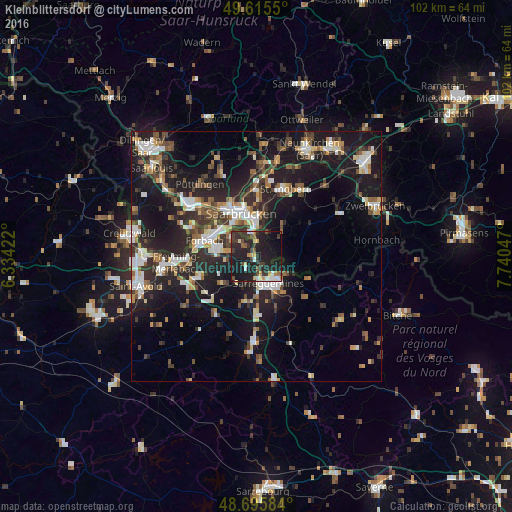
Analysis of Kleinblittersdorf night lights 2016
Square area 10x10 km:
 2.66%
2.66%90-99
3.5%80-89
1.96%70-79
4.9%60-69
1.96%50-59
2.94%40-49
5.32%30-39
8.96%20-29
19.33%10-19
42.02%0-9
6.44%Square area 50x50 km:
3.18%90-99
3.44%80-89
1.69%70-79
2.01%60-69
2.35%50-59
2.64%40-49
3.19%30-39
3.74%20-29
8.21%10-19
20.26%0-9
49.29%Clear (daylight) street map image can be seen on geolist.org.
Map coordinates:
49° 36' 55.8" North, 6° 20' 3.2" East
49° 9' 28.1" North, 7° 2' 14.4" East
48° 41' 45" North, 7° 44' 25.7" East
Some cities around Kleinblittersdorf sort by population:
• Saarbrücken
8.6 km =5.3 mi,  346°
346°
• Sankt Ingbert
14.5 km =9 mi,  23°
23°
• Sarreguemines, FR
5.8 km =3.6 mi,  157°
157°
• Forbach, FR
11.1 km =6.9 mi,  287°
287°
• Stiring-Wendel, FR
9.1 km =5.7 mi,  302°
302°
• Behren-lès-Forbach, FR
7.2 km =4.5 mi,  280°
280°
• Gersheim
11.9 km =7.4 mi,  94°
94°
• Farébersviller, FR
13 km =8.1 mi,  250°
250°
2889709 (p: 12,948)
Sources (retrieved 2019-11-25):
» Earth at Night: Flat Maps 2012, 2016