Grünwald night lights from space
Night Light of Grünwald (Bavaria) from space (Germany) Src. Average luminocity for 10x10km area is 23.2926% and for 50x50km: 18.6169%.
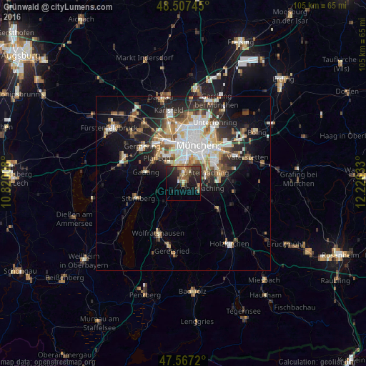
Analysis of Grünwald night lights 2016
Square area 10x10 km:
 0.99%
0.99%90-99
0.71%80-89
1.42%70-79
2.41%60-69
5.68%50-59
4.83%40-49
4.55%30-39
8.52%20-29
13.64%10-19
18.89%0-9
38.35%Square area 50x50 km:
3.8%90-99
3.84%80-89
1.81%70-79
1.87%60-69
2.38%50-59
2.43%40-49
2.14%30-39
2.77%20-29
4.93%10-19
9.57%0-9
64.47%Clear (daylight) street map image can be seen on geolist.org.
Map coordinates:
48° 30' 26.8" North, 10° 49' 12.3" East
48° 2' 22.1" North, 11° 31' 23.5" East
47° 34' 1.9" North, 12° 13' 34.8" East
Some cities around Grünwald sort by population:
• Unterhaching
7.5 km =4.7 mi,  66°
66°
• Ottobrunn
10.8 km =6.7 mi, 74°
• Taufkirchen
7 km =4.3 mi,  81°
81°
• Oberhaching
5.8 km =3.6 mi,  106°
106°
• Planegg
10.5 km =6.5 mi,  315°
315°
• Pullach im Isartal
2.4 km =1.5 mi,  356°
356°
• Neuried
7.4 km =4.6 mi, 324°
• Schäftlarn
7.4 km =4.6 mi,  222°
222°
2914064 (p: 10,836)
Sources (retrieved 2019-11-25):
» Earth at Night: Flat Maps 2012, 2016