Taufkirchen night lights from space
Night Light of Taufkirchen (Bavaria) from space (Germany) Src. Average luminocity for 10x10km area is 34.6605% and for 50x50km: 18.4127%.
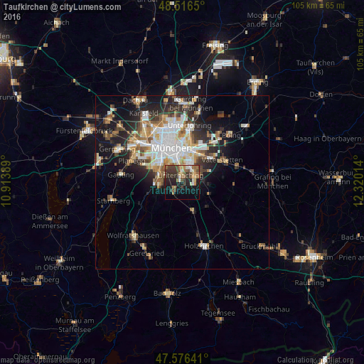
Analysis of Taufkirchen night lights 2016
Square area 10x10 km:
 2.13%
2.13%90-99
5.26%80-89
3.84%70-79
3.27%60-69
6.39%50-59
7.39%40-49
6.82%30-39
10.65%20-29
10.51%10-19
22.3%0-9
21.45%Square area 50x50 km:
3.74%90-99
3.8%80-89
1.75%70-79
1.83%60-69
2.28%50-59
2.54%40-49
2.17%30-39
2.79%20-29
5.06%10-19
9.19%0-9
64.84%Clear (daylight) street map image can be seen on geolist.org.
Map coordinates:
48° 30' 59.4" North, 10° 54' 50" East
48° 2' 55" North, 11° 37' 1.2" East
47° 34' 35.1" North, 12° 19' 12.5" East
Some cities around Taufkirchen sort by population:
• Unterhaching
1.9 km =1.2 mi,  356°
356°
• Ottobrunn
3.9 km =2.4 mi,  62°
62°
• Neubiberg
4.4 km =2.7 mi,  43°
43°
• Oberhaching
3 km =1.9 mi,  208°
208°
• Grünwald
7 km =4.3 mi,  261°
261°
• Hohenbrunn
6.3 km =3.9 mi,  90°
90°
• Pullach im Isartal
7.2 km =4.5 mi,  281°
281°
• Putzbrunn
7.9 km =4.9 mi,  67°
67°
2823812 (p: 17,791)
Sources (retrieved 2019-11-25):
» Earth at Night: Flat Maps 2012, 2016