Gochsheim night lights from space
Night Light of Gochsheim (Bavaria) from space (Germany) Src. Average luminocity for 10x10km area is 22.1345% and for 50x50km: 3.2859%.
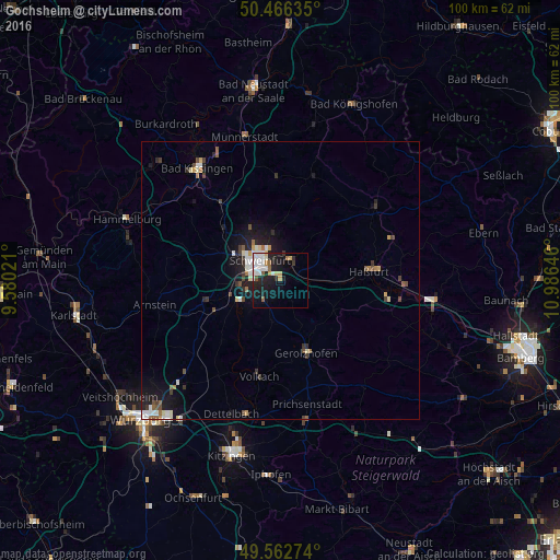
Analysis of Gochsheim night lights 2016
Square area 10x10 km:
 6.02%
6.02%90-99
5.74%80-89
1.82%70-79
1.68%60-69
0.7%50-59
2.24%40-49
0.56%30-39
1.4%20-29
6.72%10-19
17.51%0-9
55.6%Square area 50x50 km:
0.55%90-99
0.61%80-89
0.27%70-79
0.27%60-69
0.23%50-59
0.37%40-49
0.51%30-39
0.47%20-29
0.78%10-19
2.88%0-9
93.05%Clear (daylight) street map image can be seen on geolist.org.
Map coordinates:
50° 27' 58.9" North, 9° 34' 48.8" East
50° 1' 0" North, 10° 16' 60" East
49° 33' 45.9" North, 10° 59' 11.3" East
Some cities around Gochsheim sort by population:
• Schweinfurt
5.7 km =3.5 mi,  309°
309°
• Haßfurt
16.7 km =10.4 mi,  82°
82°
• Werneck
13.7 km =8.5 mi,  253°
253°
• Schonungen
4.1 km =2.5 mi,  25°
25°
• Niederwerrn
8.7 km =5.4 mi,  304°
304°
• Dittelbrunn
7.7 km =4.8 mi,  323°
323°
• Gerolzhofen
13.8 km =8.6 mi,  160°
160°
• Kolitzheim
11.7 km =7.3 mi,  197°
197°
2919620 (p: 6,495)
Sources (retrieved 2019-11-25):
» Earth at Night: Flat Maps 2012, 2016