Fürstenau night lights from space
Night Light of Fürstenau (Lower Saxony) from space (Germany) Src. Average luminocity for 10x10km area is 1.6257% and for 50x50km: 2.3213%.
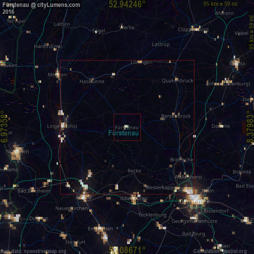
Analysis of Fürstenau night lights 2016
Square area 10x10 km:
 0.13%
0.13%90-99
0.4%80-89
0.26%70-79
0.26%60-69
0.53%50-59
0%40-49
0.13%30-39
0.4%20-29
0%10-19
0%0-9
97.88%Square area 50x50 km:
0.29%90-99
0.38%80-89
0.2%70-79
0.22%60-69
0.26%50-59
0.27%40-49
0.47%30-39
0.36%20-29
0.33%10-19
1.59%0-9
95.62%Clear (daylight) street map image can be seen on geolist.org.
Map coordinates:
52° 56' 32.9" North, 6° 58' 24.9" East
52° 31' 0" North, 7° 40' 36.1" East
52° 5' 12.2" North, 8° 22' 47.4" East
Some cities around Fürstenau sort by population:
• Bramsche
23.4 km =14.5 mi,  120°
120°
• Haselünne
21.8 km =13.5 mi,  323°
323°
• Mettingen
23.4 km =14.5 mi,  161°
161°
• Recke
16.7 km =10.4 mi,  169°
169°
• Spelle
21.9 km =13.6 mi,  220°
220°
• Bersenbrück
18.8 km =11.7 mi,  78°
78°
• Ankum
14.5 km =9 mi, 75°
• Freren
9.6 km =6 mi,  249°
249°
2923658 (p: 9,946)
Sources (retrieved 2019-11-25):
» Earth at Night: Flat Maps 2012, 2016